Map
Through a collection of photographs and 360 panoramas, explore the varied topographies, vivid colors, and material resources woven from the natural world into the textiles featured throughout this exhibition.
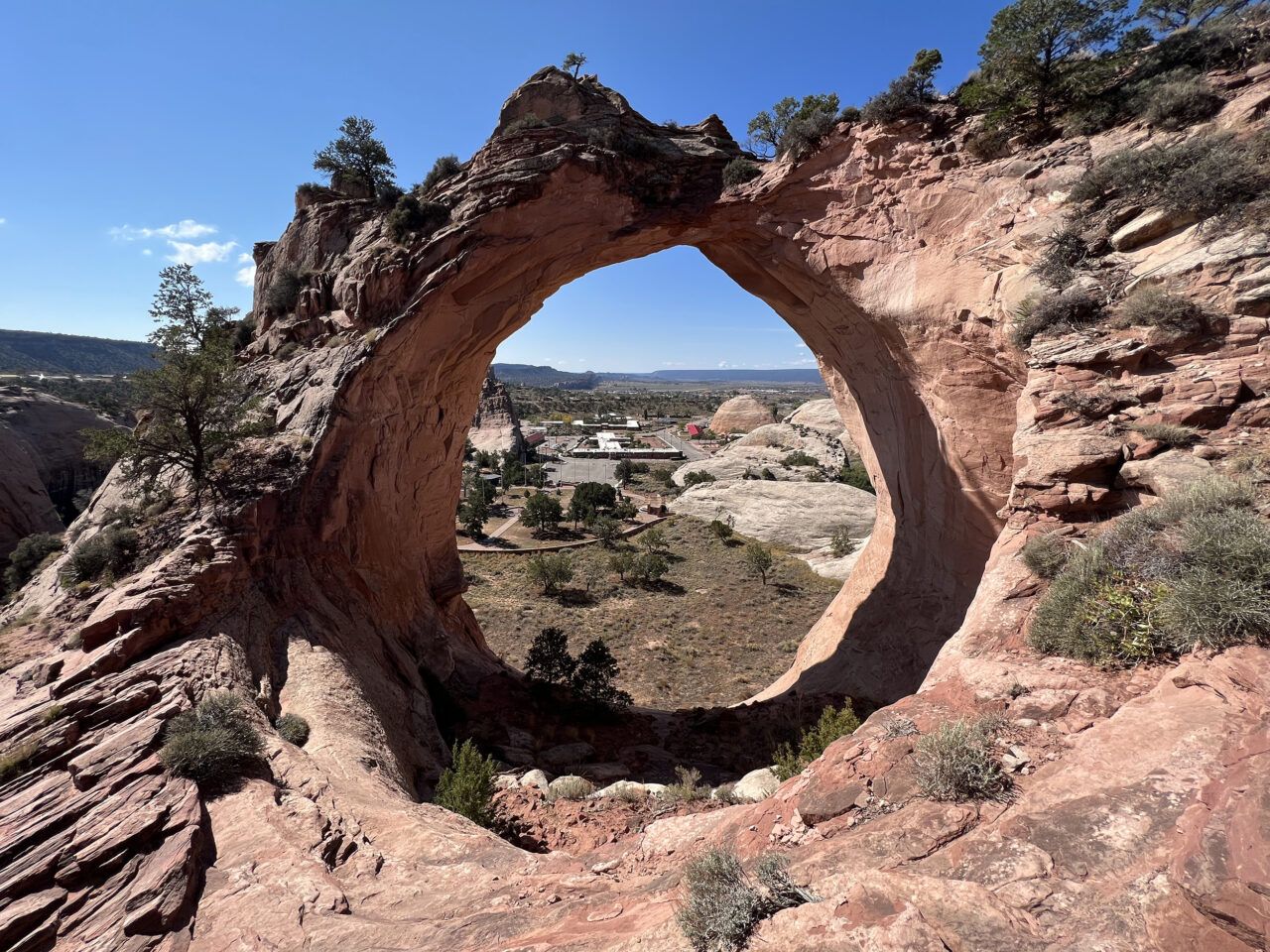
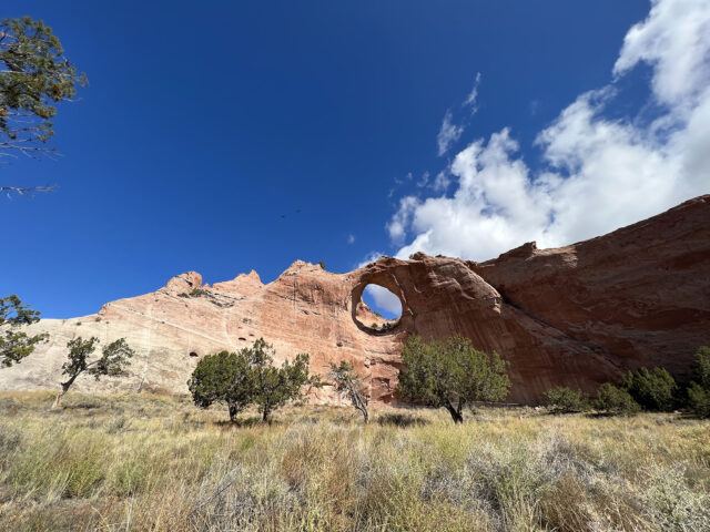
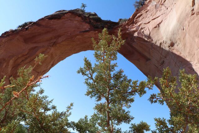
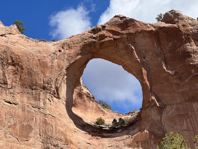
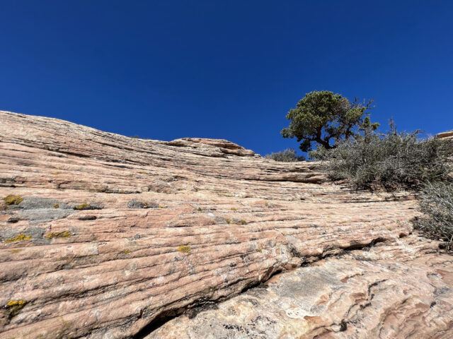
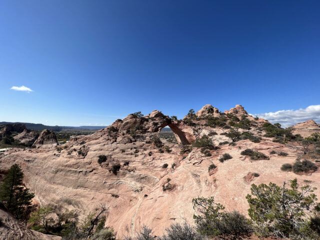
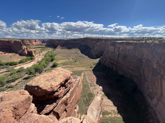
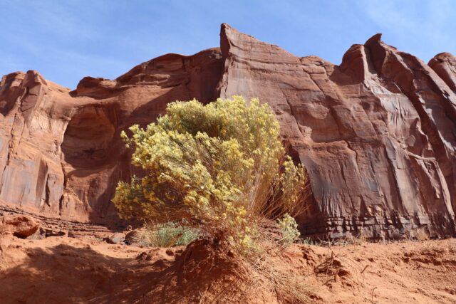
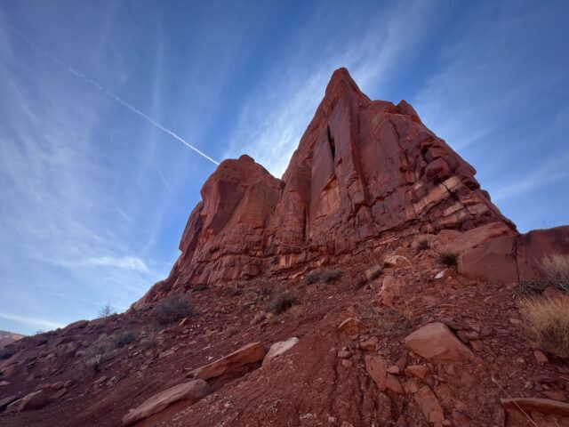
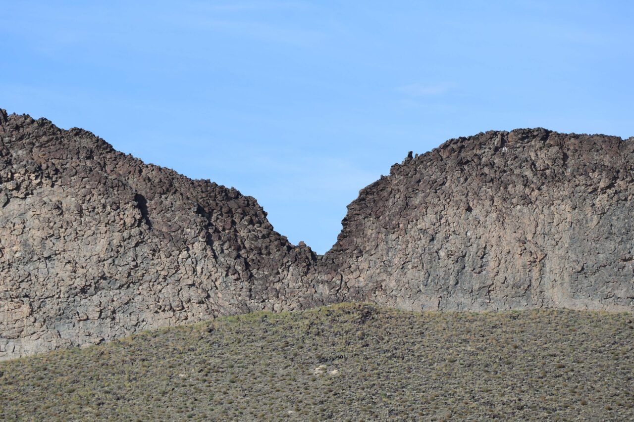
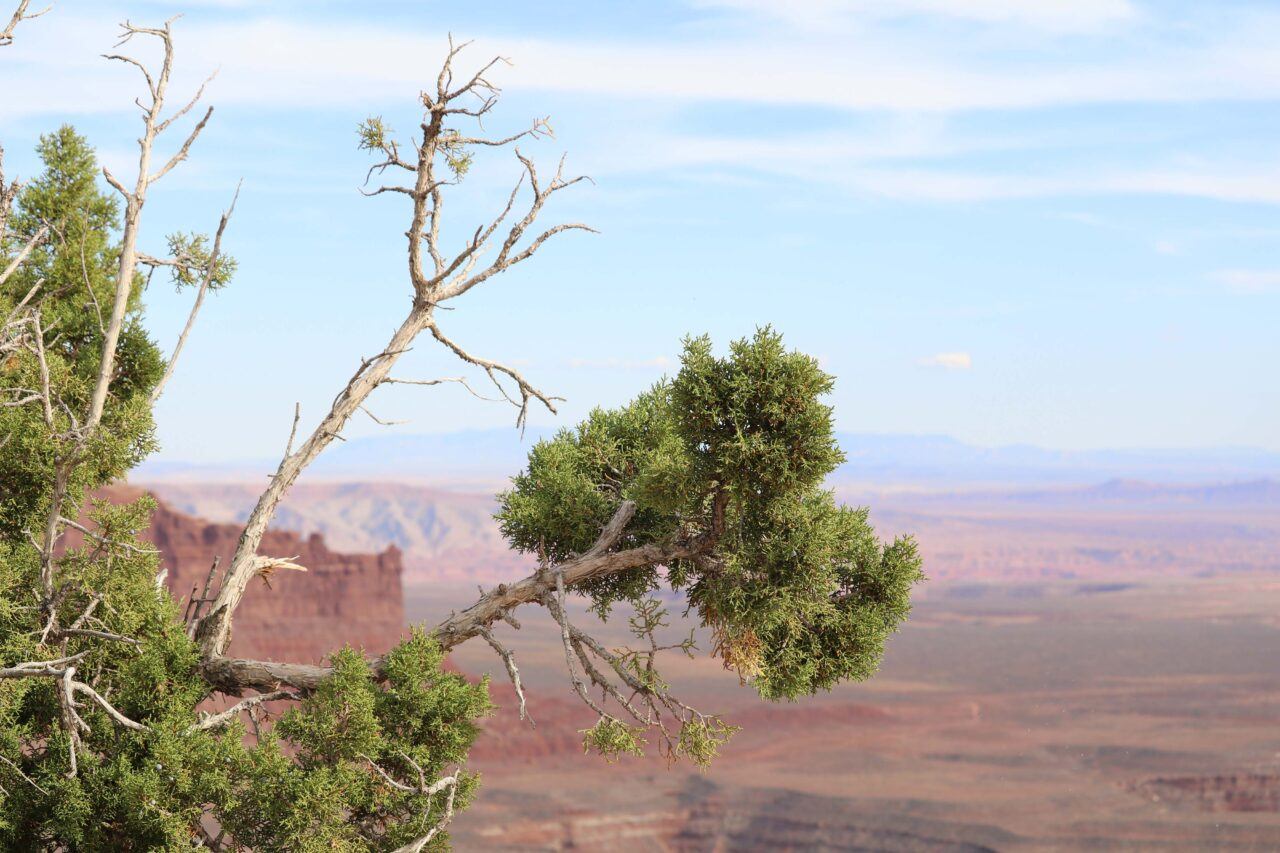
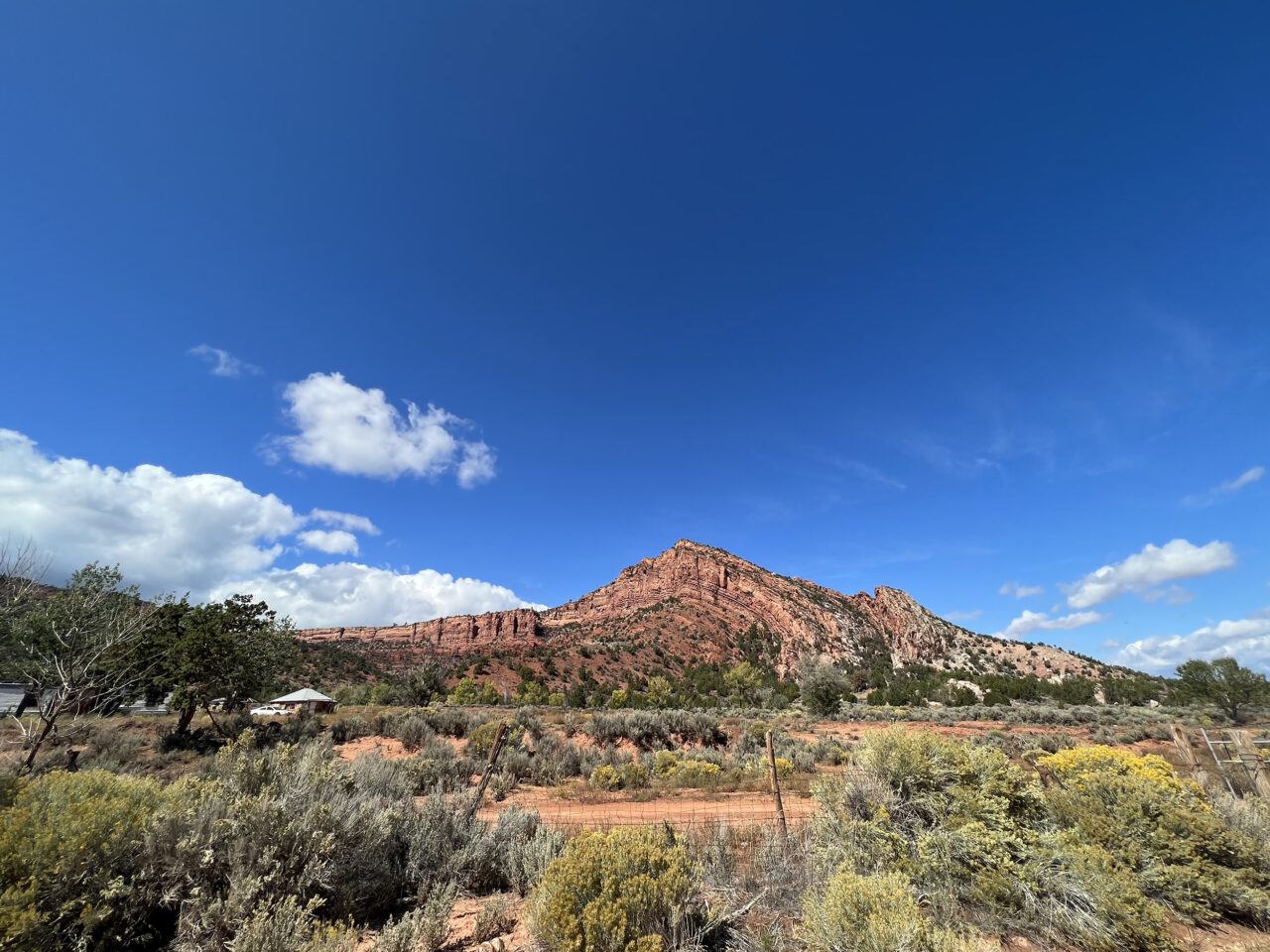
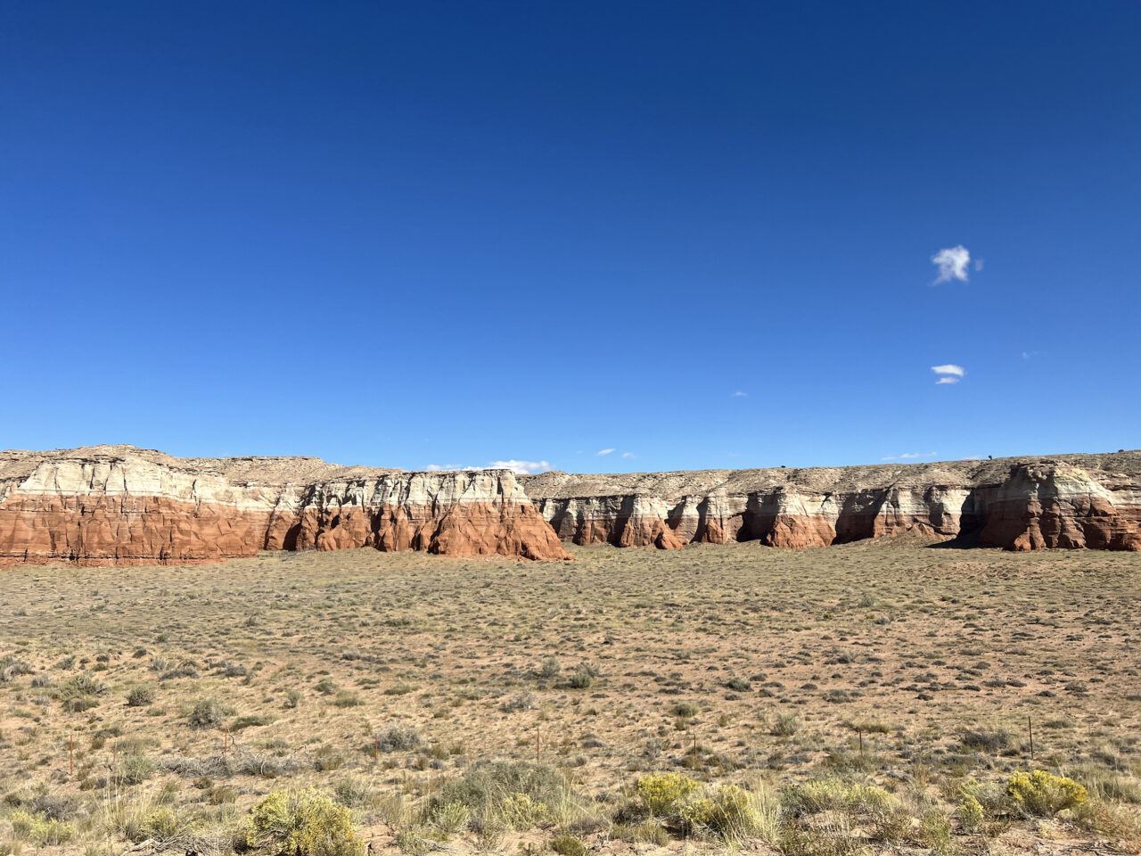
Window Rock Navajo Tribal Park
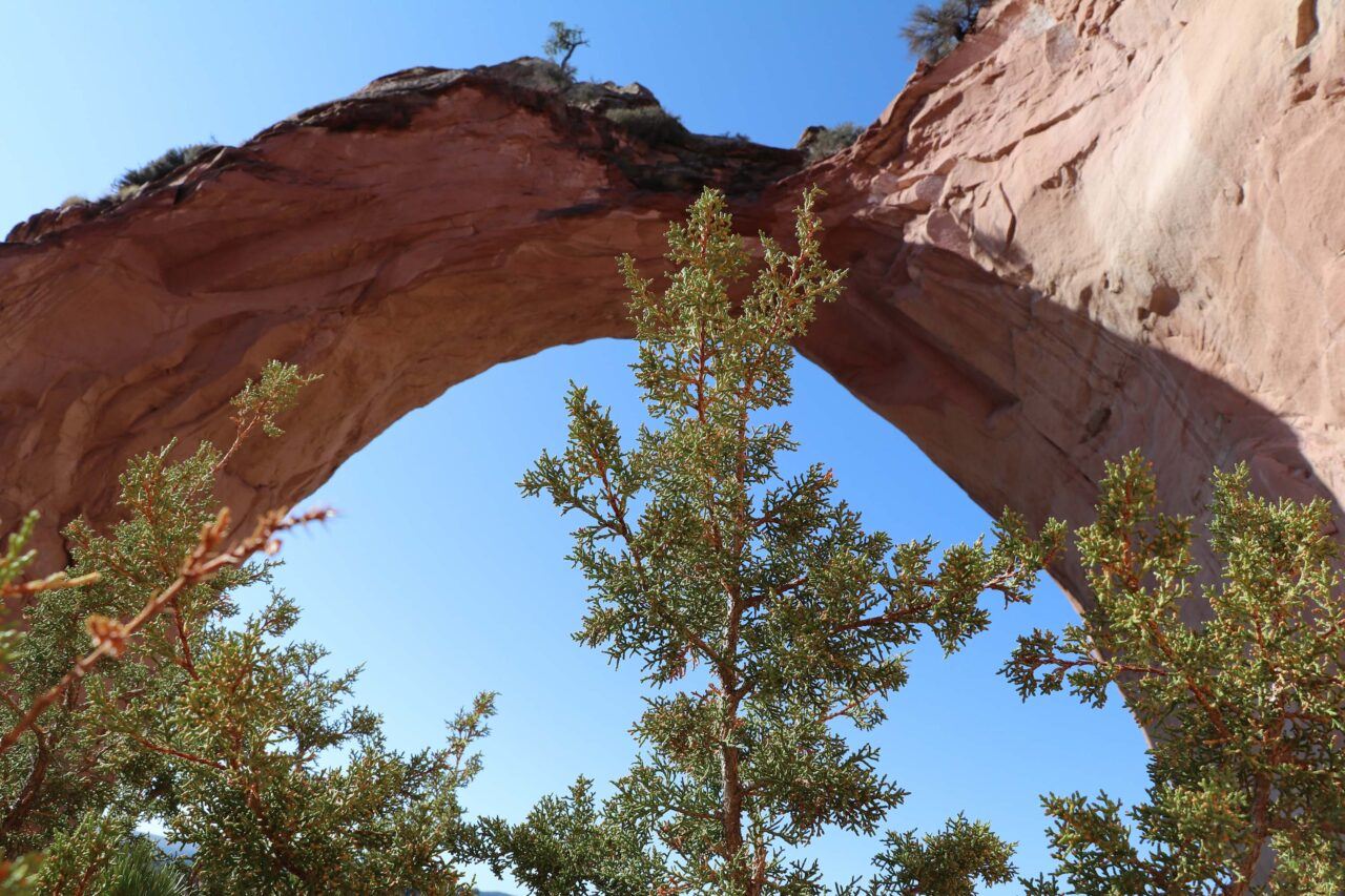
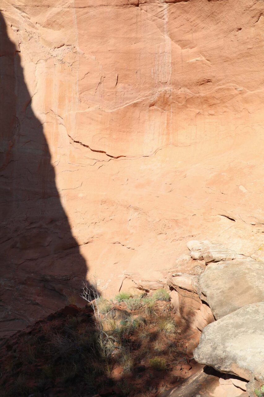
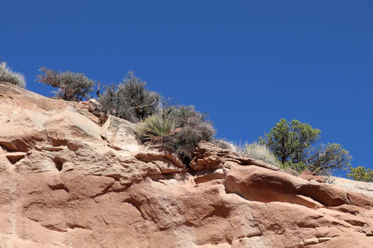
Window Rock, ceremonially named Ni’alníi’gi (Earth’s Center) and referred to as Tségháhoodzání (Perforated Rock), is both a geological formation and the capital of the Navajo Nation. It sits within the boundaries of St. Michael’s Chapter, adjacent to the state line of Arizona and New Mexico. Sand-laden winds and water carved Window Rock’s porthole shape from the Jurassic–era sandstone cliff, forming a nearly sixty-foot arch that overlooks the seat of tribal government as well as the Navajo Nation Museum. A spring once existed near Window Rock, which was used by tribal leadership to offer prayer and ask for guidance.
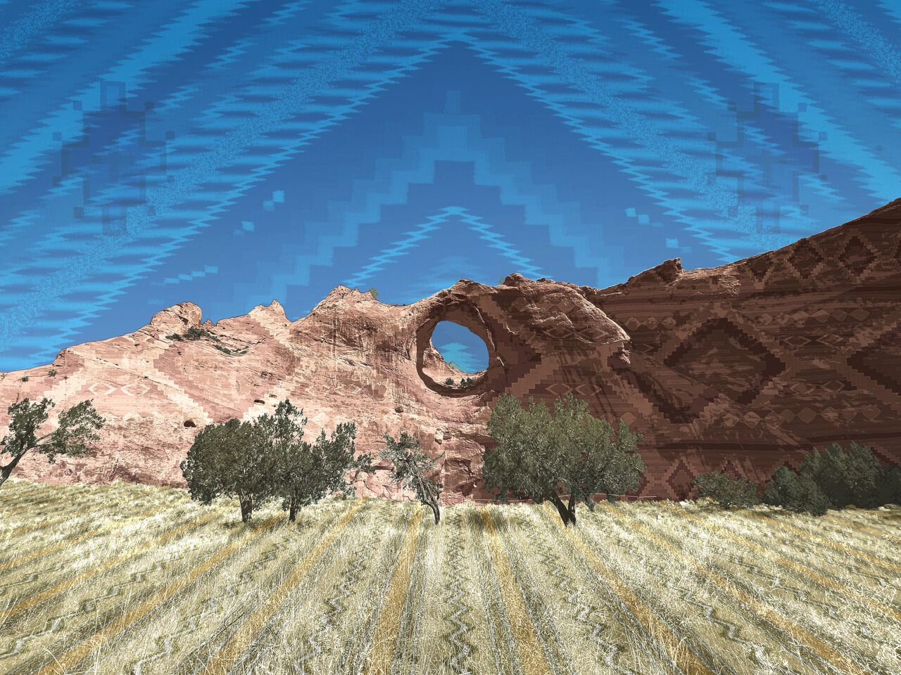
Darby Raymond-Overstreet (Diné), Woven Landscape, Window Rock, February 2022. Scanned Navajo textiles, archival print on paper. Courtesy the artist.

Window Rock Navajo Tribal Park & Veterans Memorial, Arizona, October 2021. Digital photograph. Photo: Jesse Merandy.
Rapheal Begay (Diné), Window Rock (Window Rock Tribal Park & Veterans Memorial, Window Rock, AZ), October 2021. Digital photograph. Courtesy the artist.
Rapheal Begay (Diné), Split Second (Window Rock Tribal Park & Veterans Memorial, Window Rock, AZ), October 2021. Digital photograph. Courtesy the artist.
Rapheal Begay (Diné), Side Window (Window Rock Tribal Park & Veterans Memorial, Window Rock, AZ), October 2021. Digital photograph. Courtesy the artist.

Window Rock Navajo Tribal Park & Veterans Memorial, Arizona, October 2021. Digital photograph. Photo: Jesse Merandy.
Window Rock Navajo Tribal Park & Veterans Memorial, Arizona, October 2021. Digital photograph. Photo: Jesse Merandy.
Window Rock Navajo Tribal Park & Veterans Memorial, Arizona, October 2021. Digital photograph. Photo: Jesse Merandy.
Window Rock Navajo Tribal Park & Veterans Memorial, Arizona, October 2021. Digital photograph. Photo: Jesse Merandy.

Window Rock Navajo Tribal Park & Veterans Memorial, Arizona, October 2021. Digital photograph. Photo: Jesse Merandy.

Window Rock Navajo Tribal Park & Veterans Memorial, Arizona, October 2021. Digital photograph. Photo: Jesse Merandy.


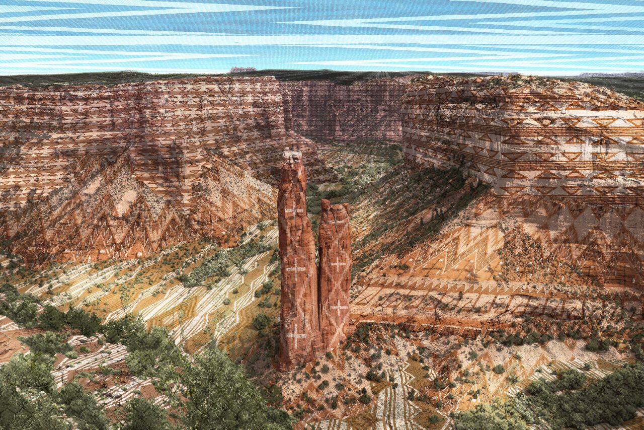
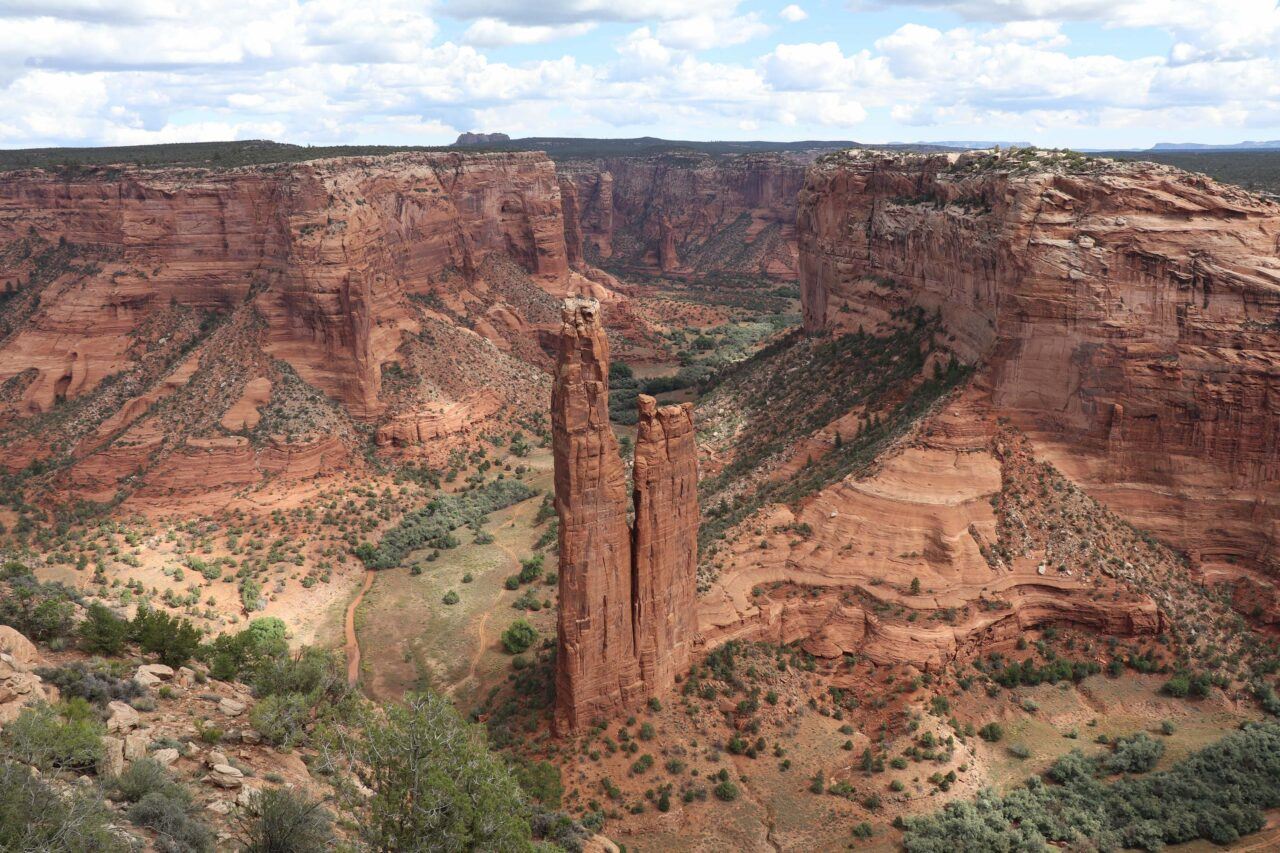
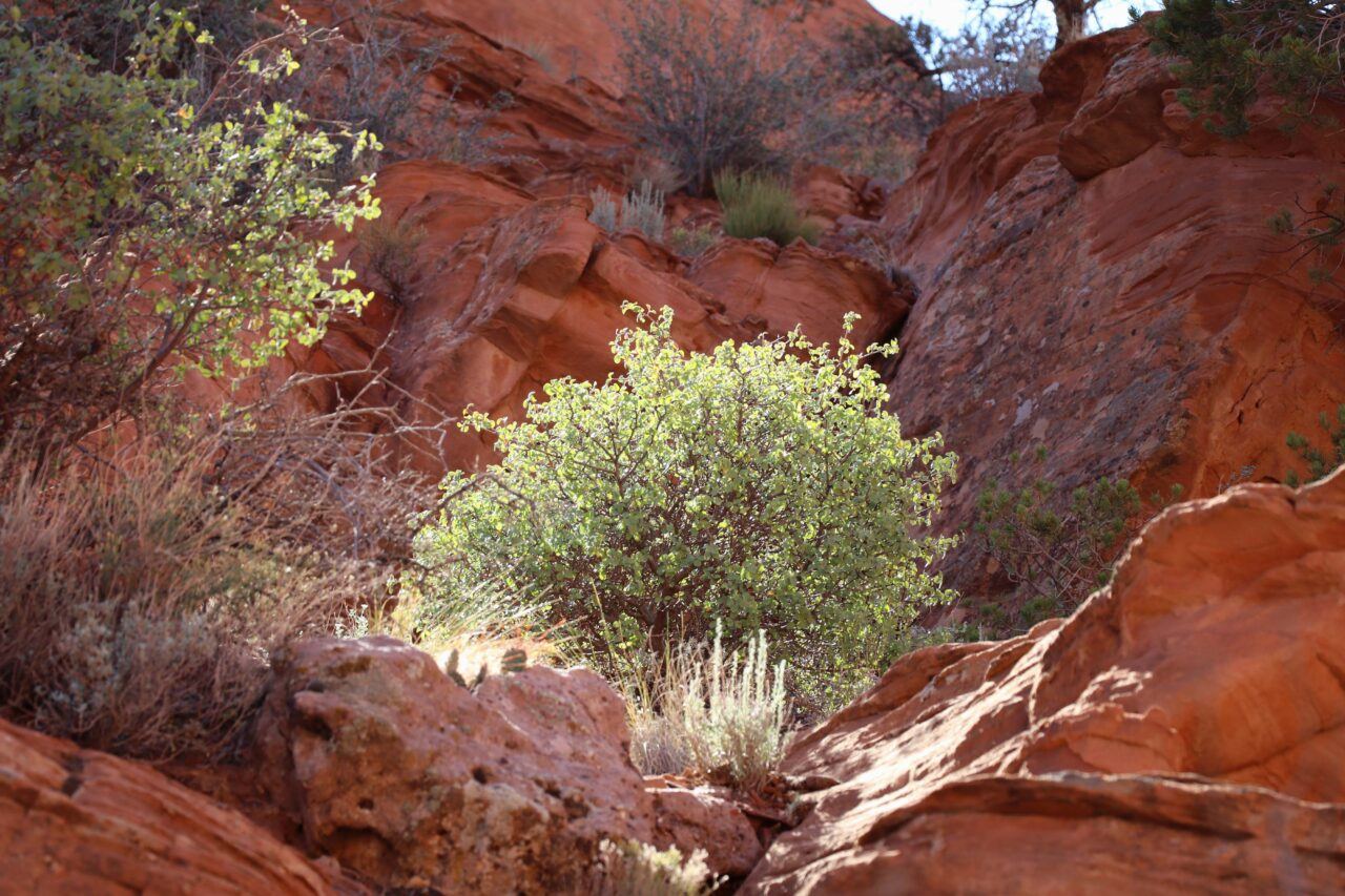
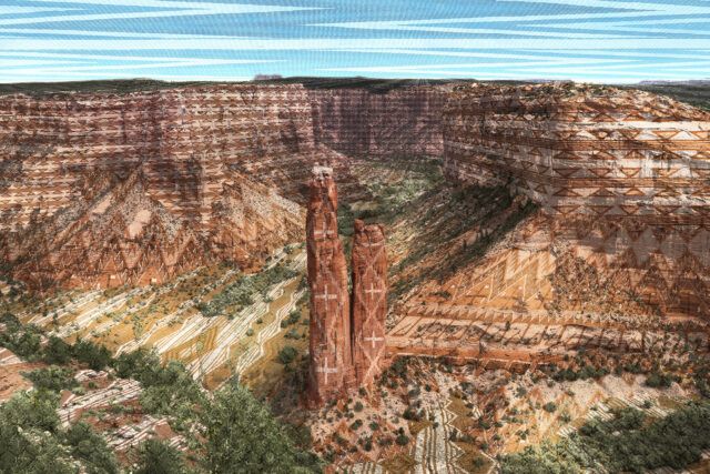
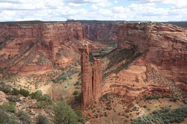
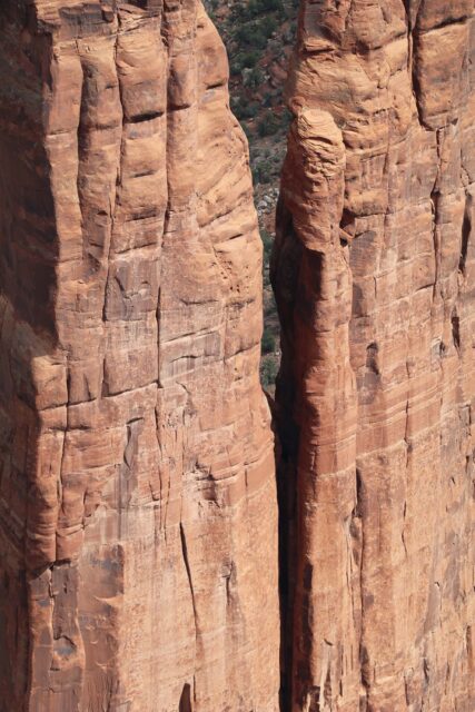
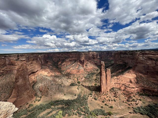
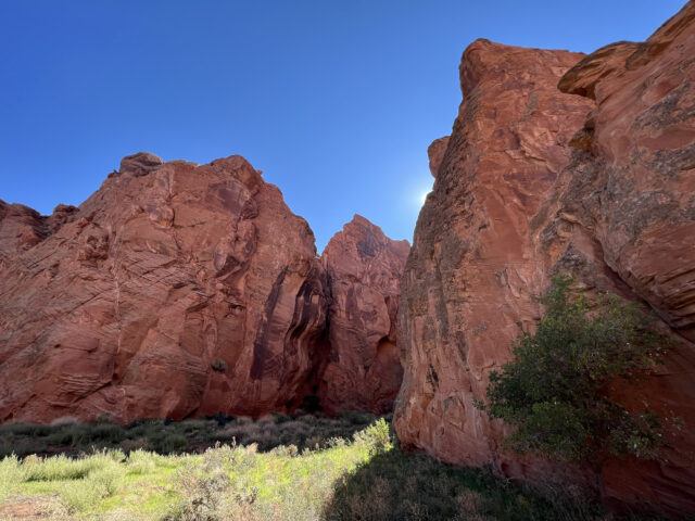
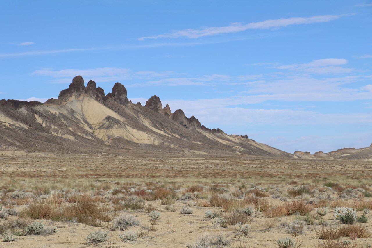
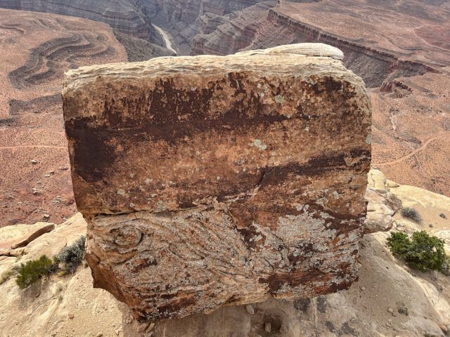
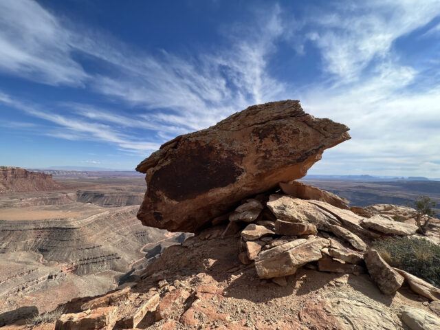
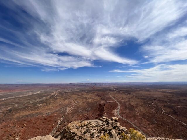
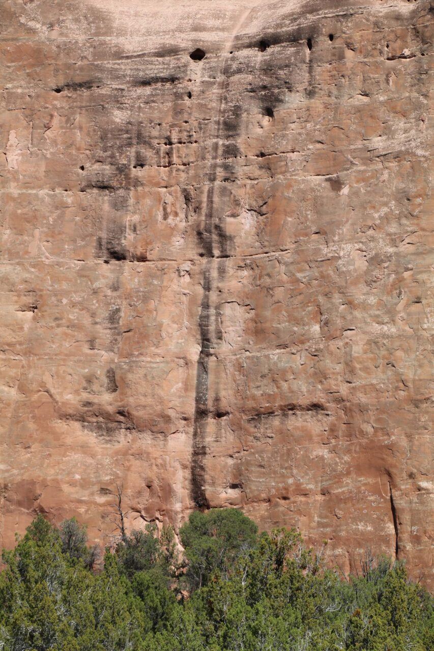
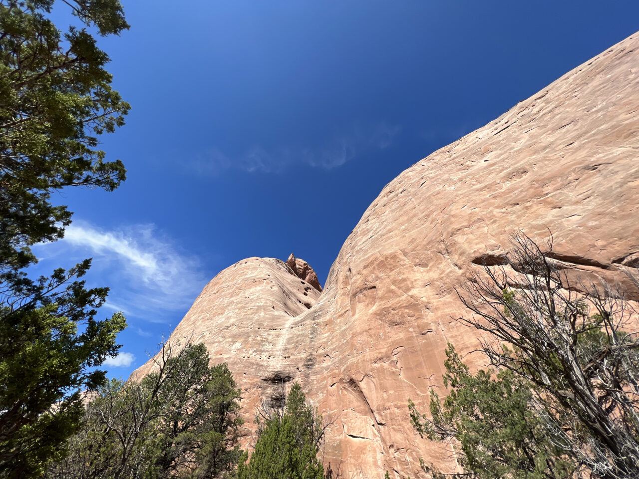
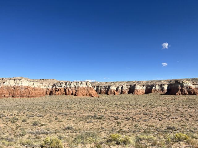
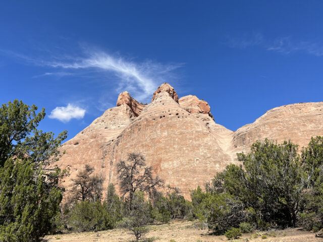
Spider Rock, Canyon de Chelly National Monument
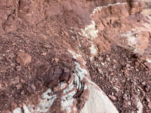
Canyon de Chelly, named Tséyi’ (Inside the Rock), was designated as a national monument in 1931, under the jurisdiction of the National Park Service and held in trust by the Navajo Nation. Spider Rock, the sandstone monolith that rises from the canyon floor, is a culturally and historically significant site to the Diné (Navajo) people. As the setting for the creation story of Na’ashjéii Asdzáá (Spider Woman), it is central to the origins of Diné weaving and the cosmological relationships that continue to sustain it. It is believed that Spider Woman wove the universe and descended into the canyon to give the knowledge of weaving to the Diné people. Many weavers incorporate a Spider Woman cross into their textiles and basketry as a way to honor these teachings.
Darby Raymond-Overstreet (Diné), Woven Landscape, Canyon de Chelly, February 2022. Scanned Navajo textiles, archival print on paper. Courtesy the artist.
Rapheal Begay (Diné), Spider Rock (Canyon de Chelly National Monument, Canyon de Chelly, AZ), October 2021. Digital photograph. Courtesy the artist.
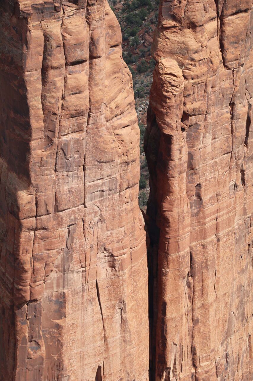
Rapheal Begay (Diné), Spider Rock Detail (Canyon de Chelly National Monument, Canyon de Chelly, AZ), October 2021. Digital photograph. Courtesy the artist.

Rapheal Begay (Diné), Slick (Canyon de Chelly National Monument, Canyon de Chelly, AZ), October 2021. Digital photograph. Courtesy the artist.
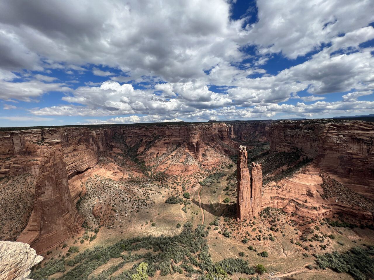
Spider Rock, Canyon de Chelly National Monument, Arizona, October 2021. Digital photograph. Photo: Jesse Merandy.

Canyon de Chelly National Monument, Arizona, October 2021. Digital photograph. Photo: Jesse Merandy.

Canyon de Chelly National Monument, Arizona, October 2021. Digital photograph. Photo: Jesse Merandy.
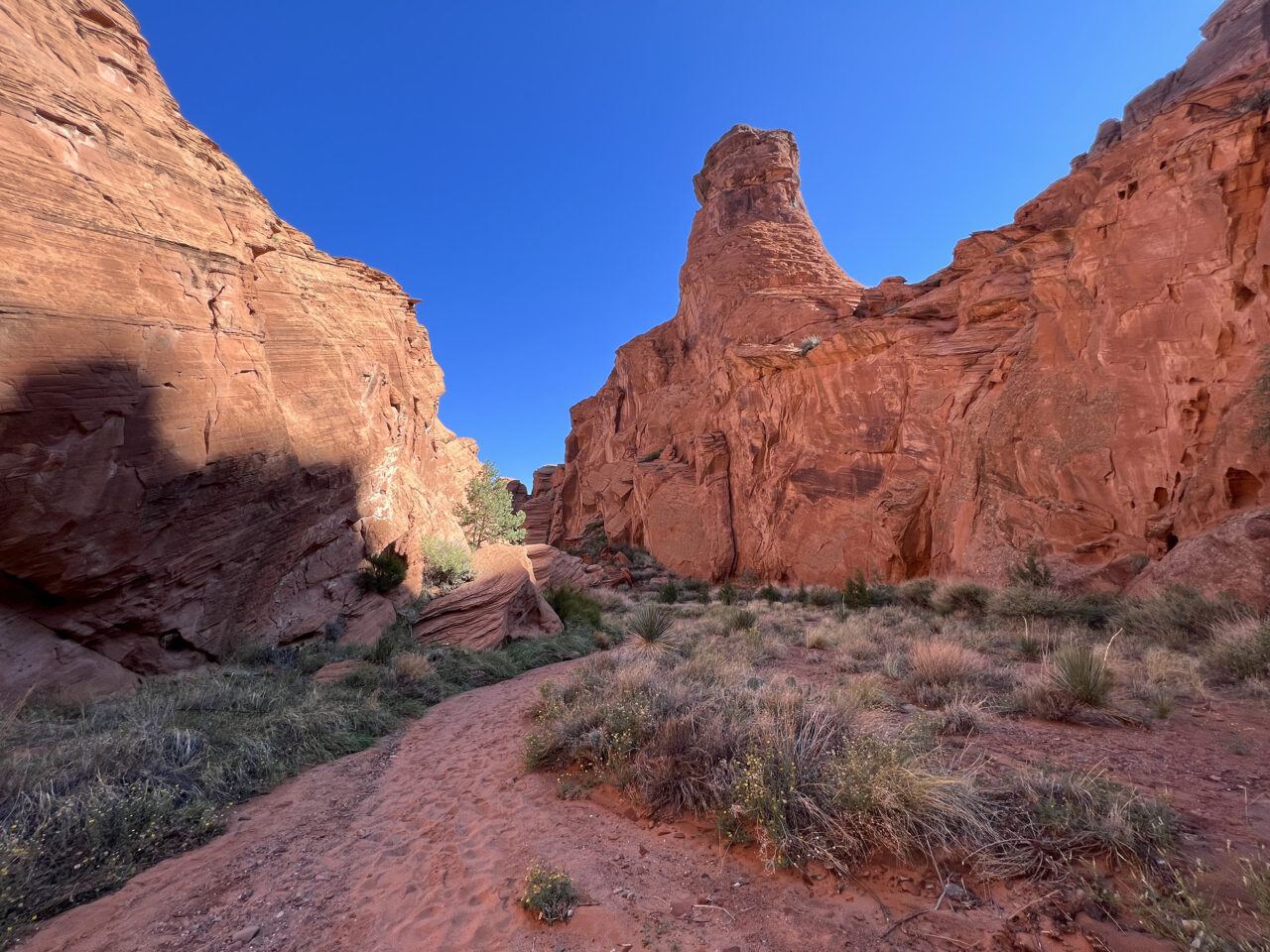
Canyon de Chelly National Monument, Arizona, October 2021. Digital photograph. Photo: Jesse Merandy.
Rapheal Begay (Diné), Glow Growth (Canyon de Chelly National Monument, Canyon de Chelly, AZ), October 2021. Digital photograph. Courtesy the artist.
Canyon de Chelly National Monument, Arizona, October 2021. Digital photograph. Photo: Jesse Merandy.
Canyon de Chelly National Monument, Arizona, October 2021. Digital photograph. Photo: Jesse Merandy.


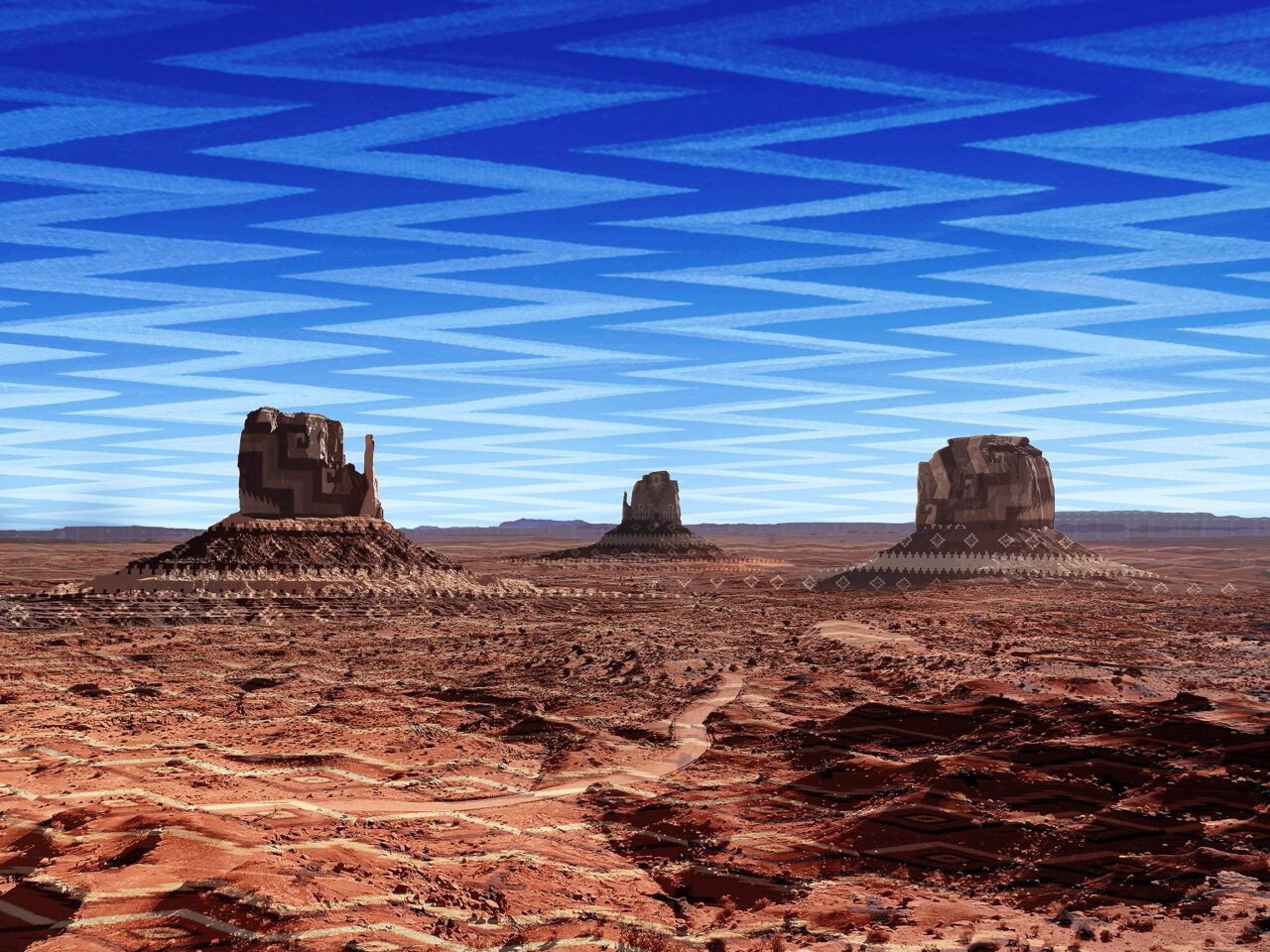
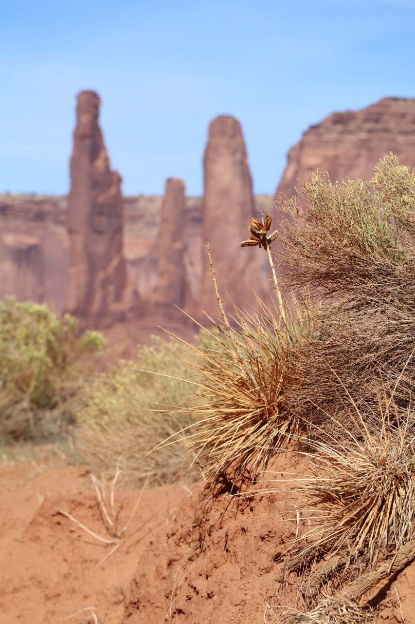
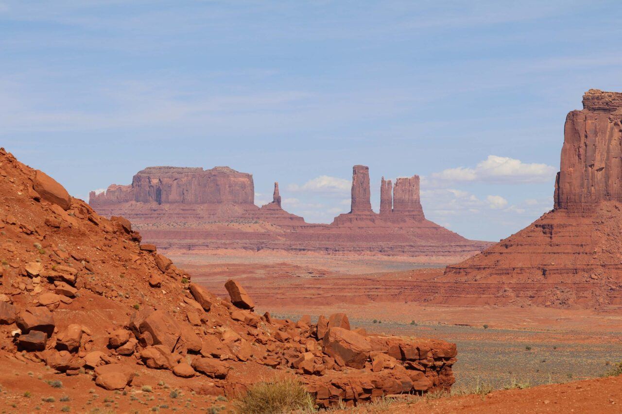
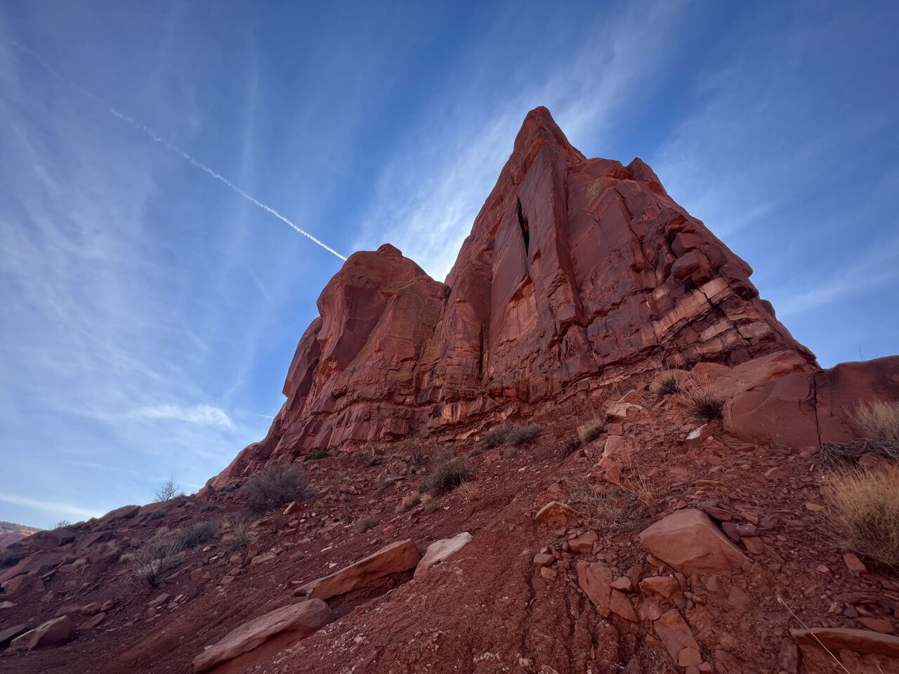
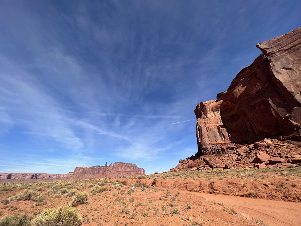
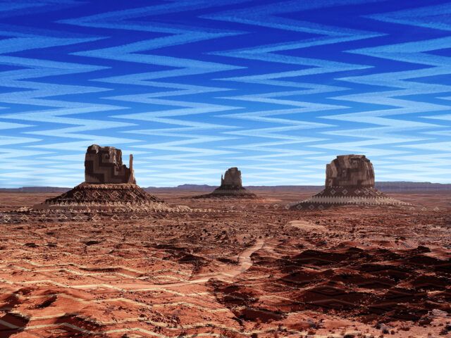
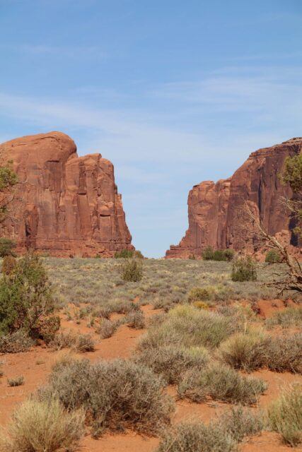
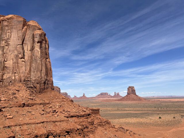
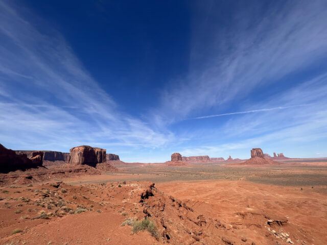
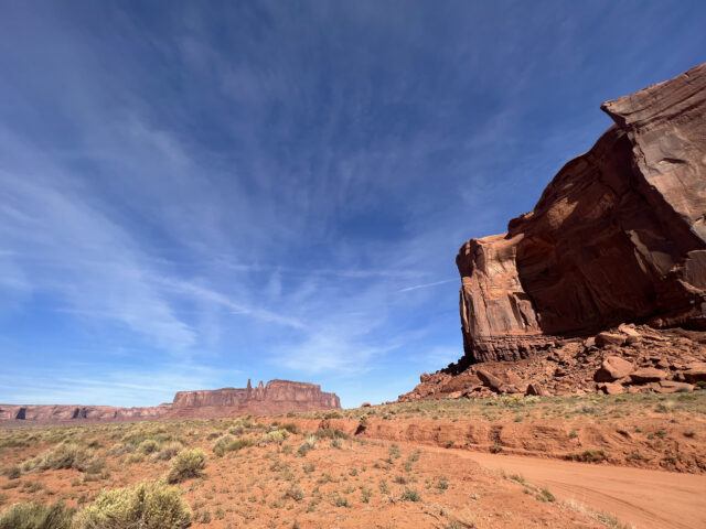
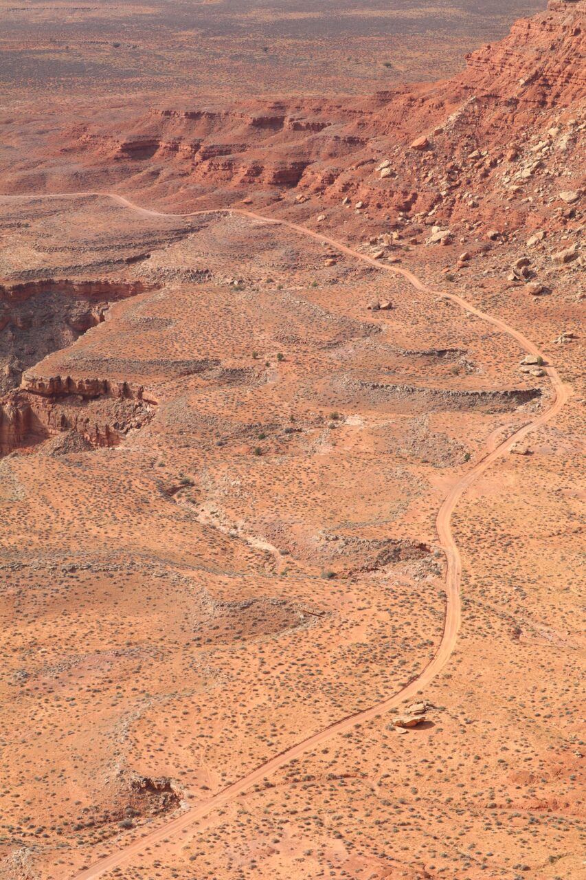
Monument Valley Navajo Tribal Park
Monument Valley (Tsé Bii’ Ndzisgaii), which stretches over 30,000 acres in northeast Arizona and southern Utah, was established as a Navajo Tribal Park in 1960. Scattered across the valley’s terrain are towering sandstone formations that rise 400 to 1,000 feet from what was once a lowland basin. Frequently named for their distinctive shapes—such as the Three Sisters, Elephant Butte, and West and East Mitten Buttes—these natural features are the remnants of deposited layers of sediment eroded by wind and water over the course of fifty million years.
Darby Raymond-Overstreet (Diné), Woven Landscape, Monument Valley, February 2022. Scanned Navajo textiles, archival print on paper. Courtesy the artist.
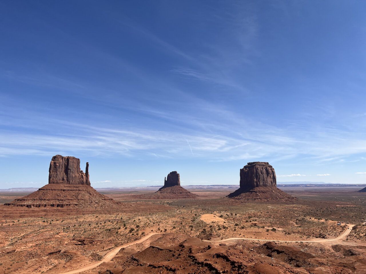
West and East Mitten Buttes, Monument Valley Navajo Tribal Park, Arizona and Utah, October 2021. Digital photograph. Photo: Jesse Merandy.
Rapheal Begay (Diné), Rock Face (Monument Valley Tribal Park, UT and AZ), October 2021. Digital photograph. Courtesy the artist.
Rapheal Begay (Diné), Terrain (Monument Valley Tribal Park, UT and AZ), October 2021. Digital photograph. Courtesy the artist.

Rapheal Begay (Diné), Mesa View (Monument Valley Tribal Park, UT and AZ), October 2021. Digital photograph. Courtesy the artist.
Rapheal Begay (Diné), Rain God Mesa (Monument Valley Tribal Park, UT and AZ), October 2021. Digital photograph. Courtesy the artist.
Rapheal Begay (Diné), Three Sisters (Monument Valley Tribal Park, UT and AZ), October 2021. Digital photograph. Courtesy the artist.
Rapheal Begay (Diné), North Window Overlook (Monument Valley Tribal Park, UT and AZ), October 2021. Digital photograph. Courtesy the artist.
Cly Butte, Monument Valley Navajo Tribal Park, Arizona and Utah, October 2021. Digital photograph. Photo: Jesse Merandy.

North Window Overlook, Monument Valley Navajo Tribal Park, Arizona and Utah, October 2021. Digital photograph. Photo: Jesse Merandy.

Artist Point Overlook, Monument Valley Navajo Tribal Park, Arizona and Utah, October 2021. Digital photograph. Photo: Jesse Merandy.
Rain God Mesa, Monument Valley Navajo Tribal Park, Arizona and Utah, October 2021. Digital photograph. Photo: Jesse Merandy.


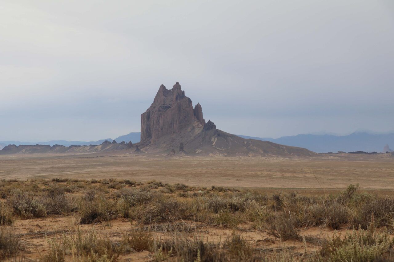
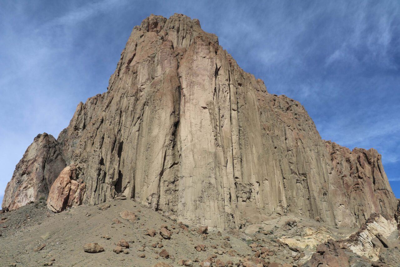
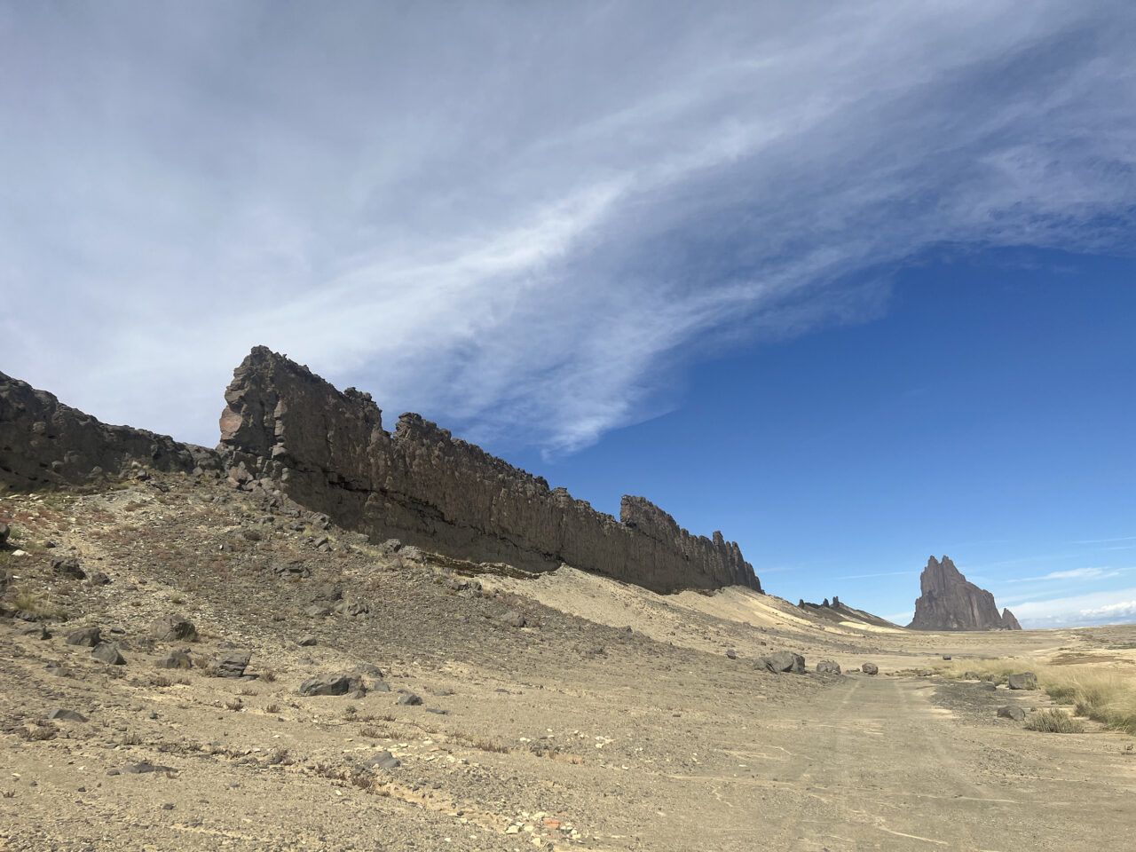
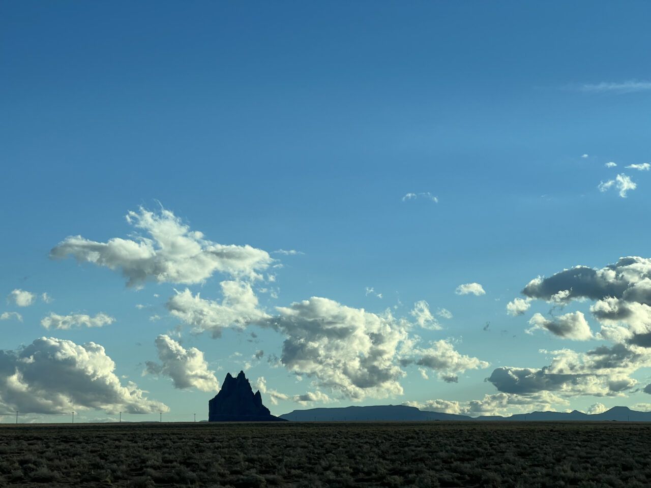
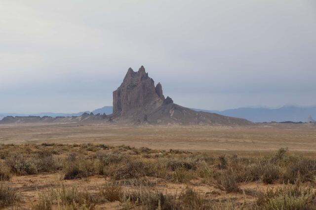
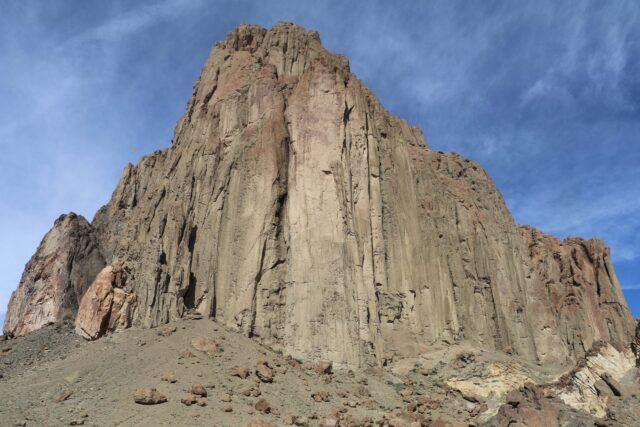
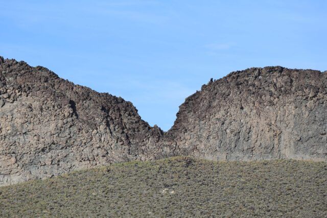
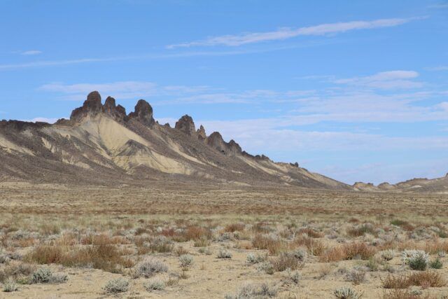
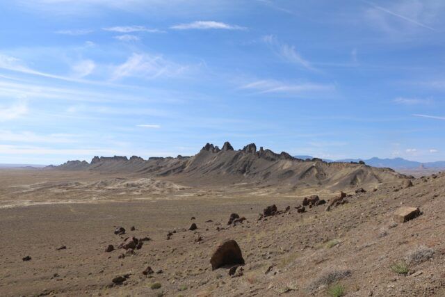
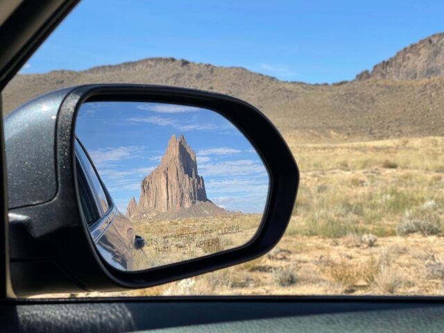
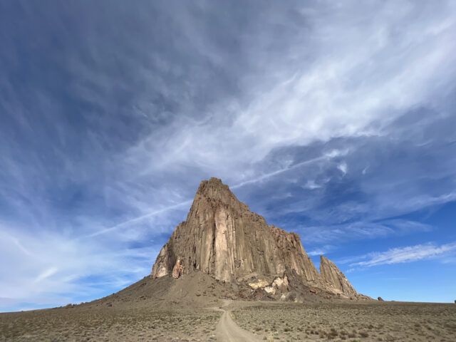
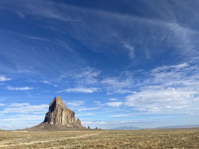
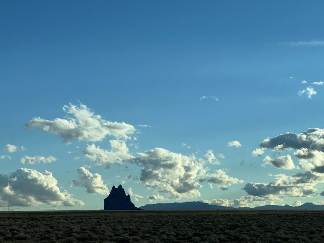
Shiprock Pinnacle
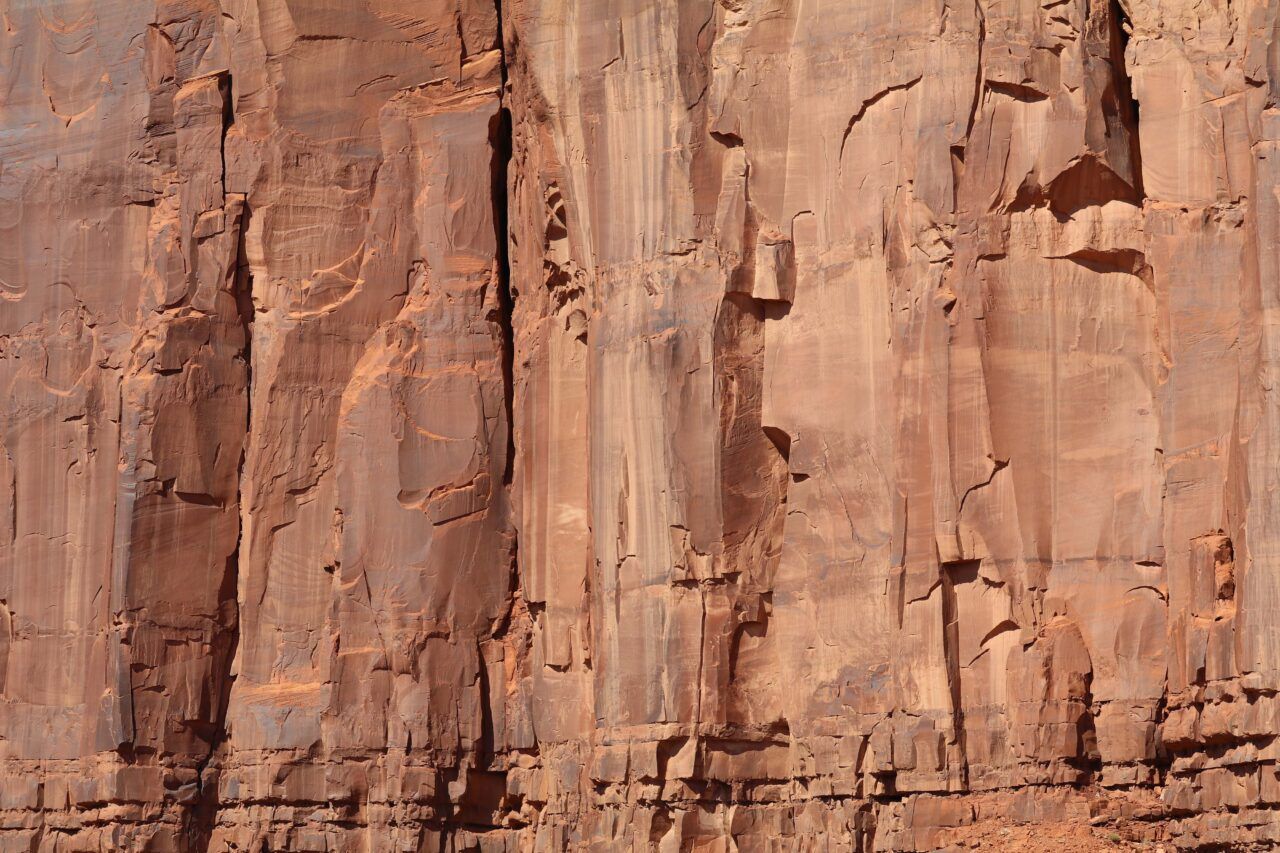
Shiprock Pinnacle (Tsé Bitʼaʼí, which translates as “rock with wings” or “winged rock”), is a geological formation located in San Juan County, New Mexico, near the Diné (Navajo) settlement of Shiprock. Exposed by erosion over millions of years, this volcanic neck is the hardened remains of lava once contained within a larger volcanic land structure. Rising 1,583 feet above the surrounding high-desert plain, the distinctive landmark also features two walls of volcanic rock, which radiate out from the pinnacle to form its distinctive “wings.” In Diné stories, the site was the scene of an epic battle between Nayenezgani (Slayer of the Enemy Gods) and the Tse’nahale (a pair of creatures resembling gigantic eagles), which lived atop the pinnacle and terrorized the local population. The material remnants of this story are made visible in the geological features of this site, suggesting its Diné place name.
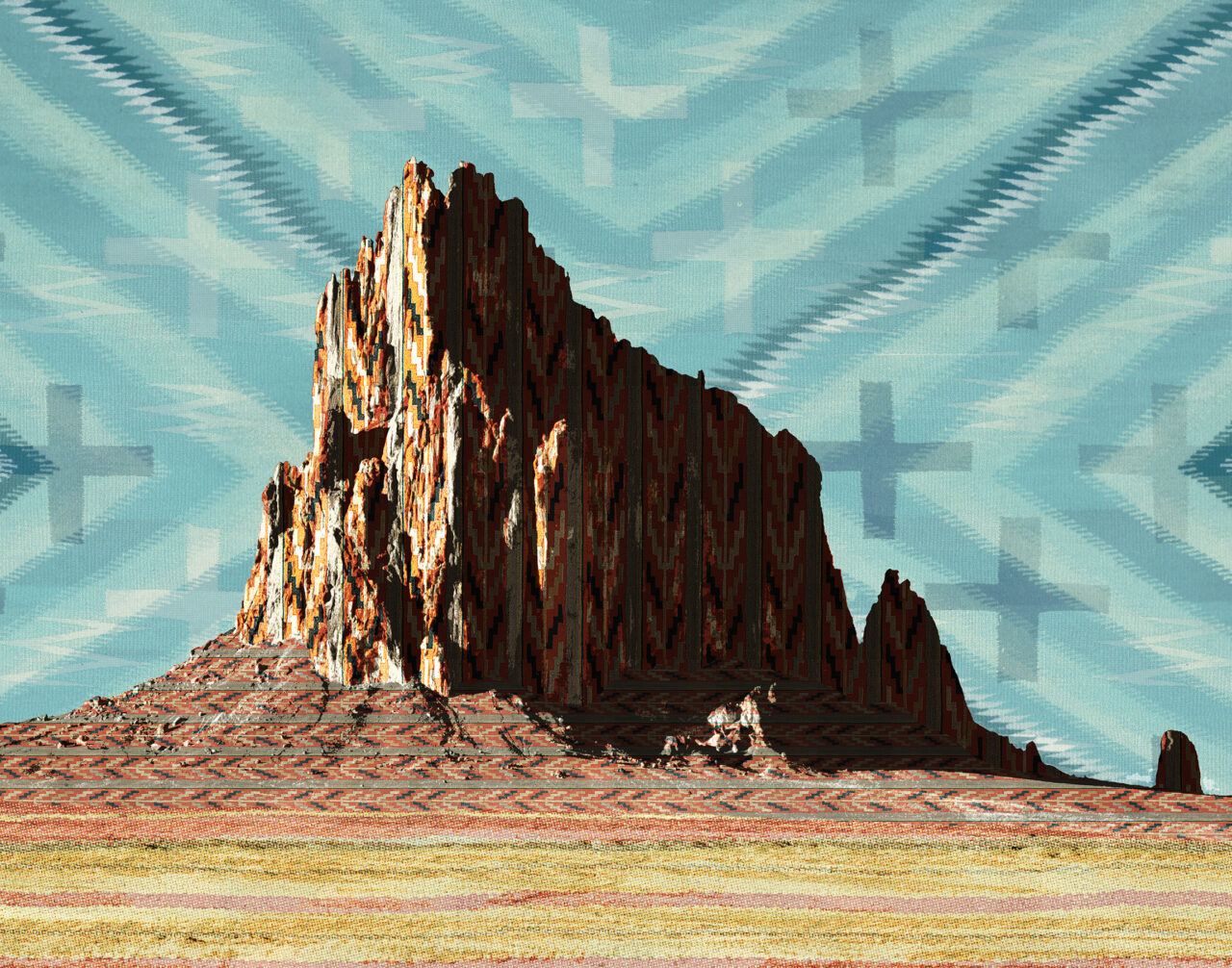
Darby Raymond-Overstreet (Diné), Woven Landscape, Shiprock, January 2018. Scanned Navajo textiles, archival print on pearl paper. Courtesy the artist.
Rapheal Begay (Diné), Pinnacle (Shiprock Pinnacle, Shiprock, NM), October 2021. Digital photograph. Courtesy the artist.
Rapheal Begay (Diné), Pinnacle Base (Shiprock Pinnacle, Shiprock, NM), October 2021. Digital photograph. Courtesy the artist.
Rapheal Begay (Diné), Rock with Wings (Shiprock Pinnacle, Shiprock, NM), October 2021. Digital photograph. Courtesy the artist.
Rapheal Begay (Diné), Spikes (Shiprock Pinnacle, Shiprock, NM), October 2021. Digital photograph. Courtesy the artist.

Rapheal Begay (Diné), Southwest Extension (Shiprock Pinnacle, Shiprock, NM), October 2021. Digital photograph. Courtesy the artist.

Rapheal Begay (Diné), Shiprock (Shiprock Pinnacle, Shiprock, NM), October 2021. Digital photograph. Courtesy the artist.

Rapheal Begay (Diné), Indigenous (Shiprock Pinnacle, Shiprock, NM), October 2021. Digital photograph. Courtesy the artist.
Shiprock Dike, New Mexico, October 2021. Digital photograph. Photo: Jesse Merandy.

Shiprock Pinnacle, New Mexico, October 2021. Digital photograph. Photo: Jesse Merandy.
Shiprock Pinnacle, New Mexico, October 2021. Digital photograph. Photo: Jesse Merandy.
Shiprock Pinnacle, New Mexico, October 2021. Digital photograph. Photo: Jesse Merandy.


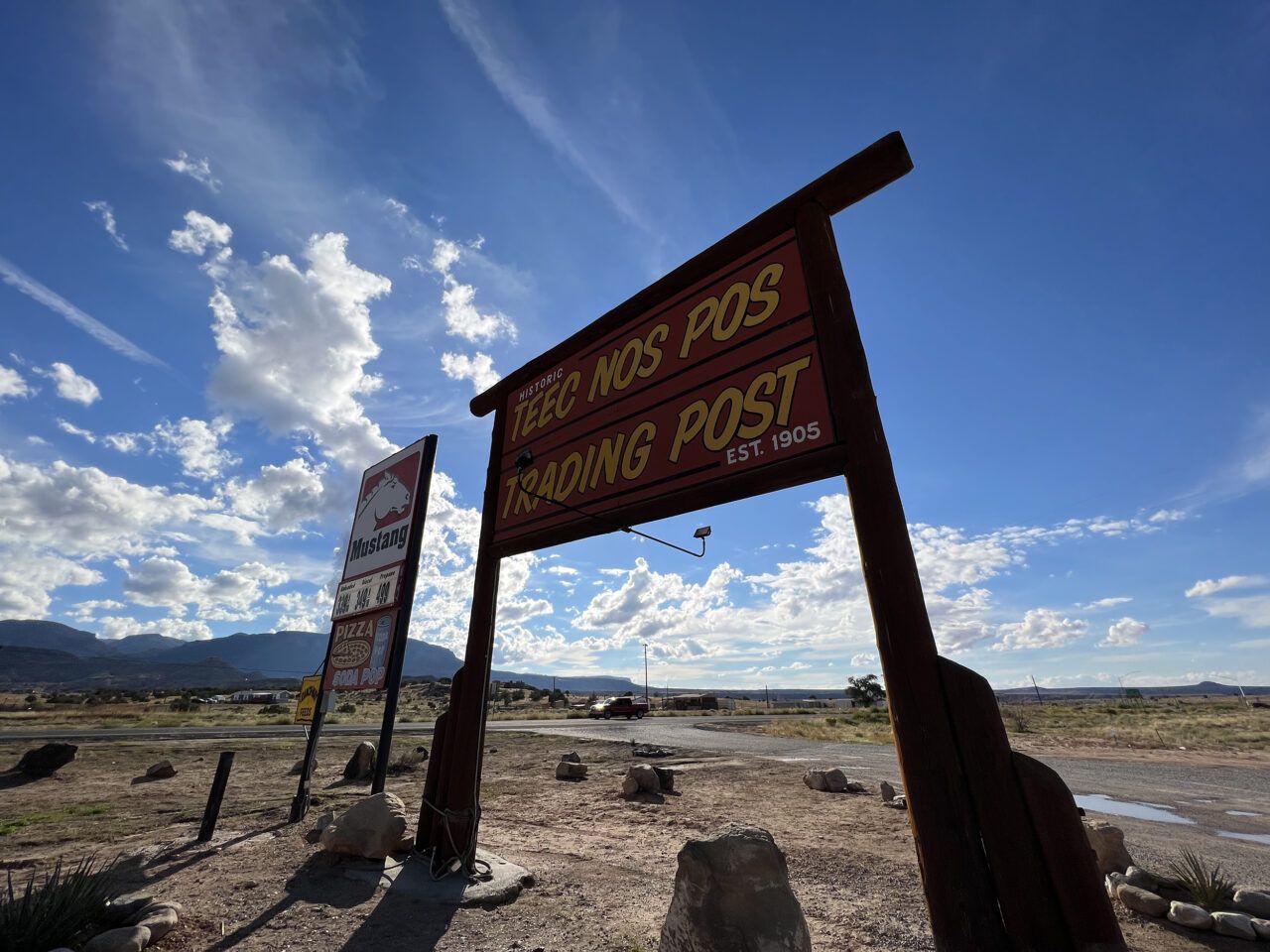
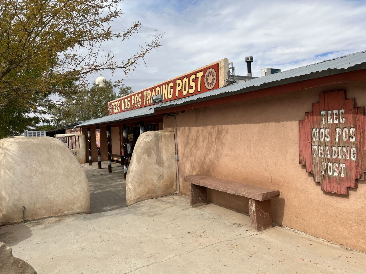
Teec Nos Pos Trading Post, Arizona
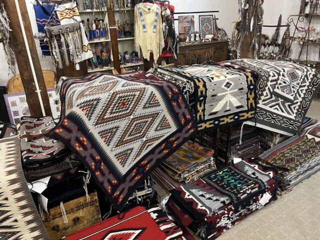
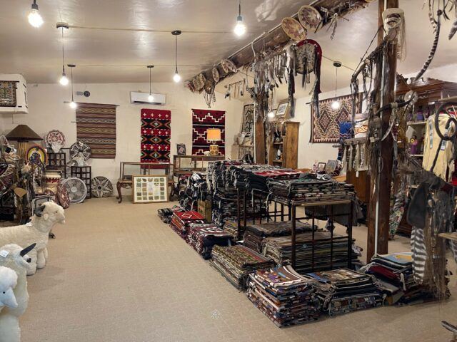
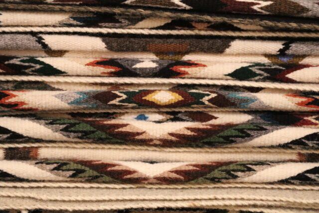
Teec Nos Pos (T’iis nazbas, “circle of cottonwoods”) Trading Post was founded by Hambleton B. Noel in 1905 near the Four Corners area where Colorado, Arizona, New Mexico, and Utah converge. As a hub for supplies and raw materials, Teec Nos Pos was an essential intermediary between the crafts market and local Diné (Navajo) weavers, emerging as an important distribution center and a driver of design innovations in the 1930s and 1940s. Its regionally distinctive and highly prized “jewel pattern” features unusual geometric motifs with black borders and brightly colored outlines set against a solid-gray-hued background. Rebuilt in 1959 after the original site burned down, the trading post remains an important marketplace for local artists, featuring a “rug room” dedicated to textiles and other crafts. It also continues to serve as a vital stop for provisions, offering fuel, groceries, and supplies for local residents.

Teec Nos Pos Trading Post, Arizona, October 2021. Digital photograph. Photo: Jesse Merandy.
Teec Nos Pos Trading Post, Arizona, October 2021. Digital photograph. Photo: Jesse Merandy.
Teec Nos Pos Trading Post, Arizona, October 2021. Digital photograph. Photo: Jesse Merandy.
Rapheal Begay (Diné), Context (Teec Nos Pos Trading Post, Teec Nos Pos, AZ), October 2021. Digital photograph. Courtesy the artist.

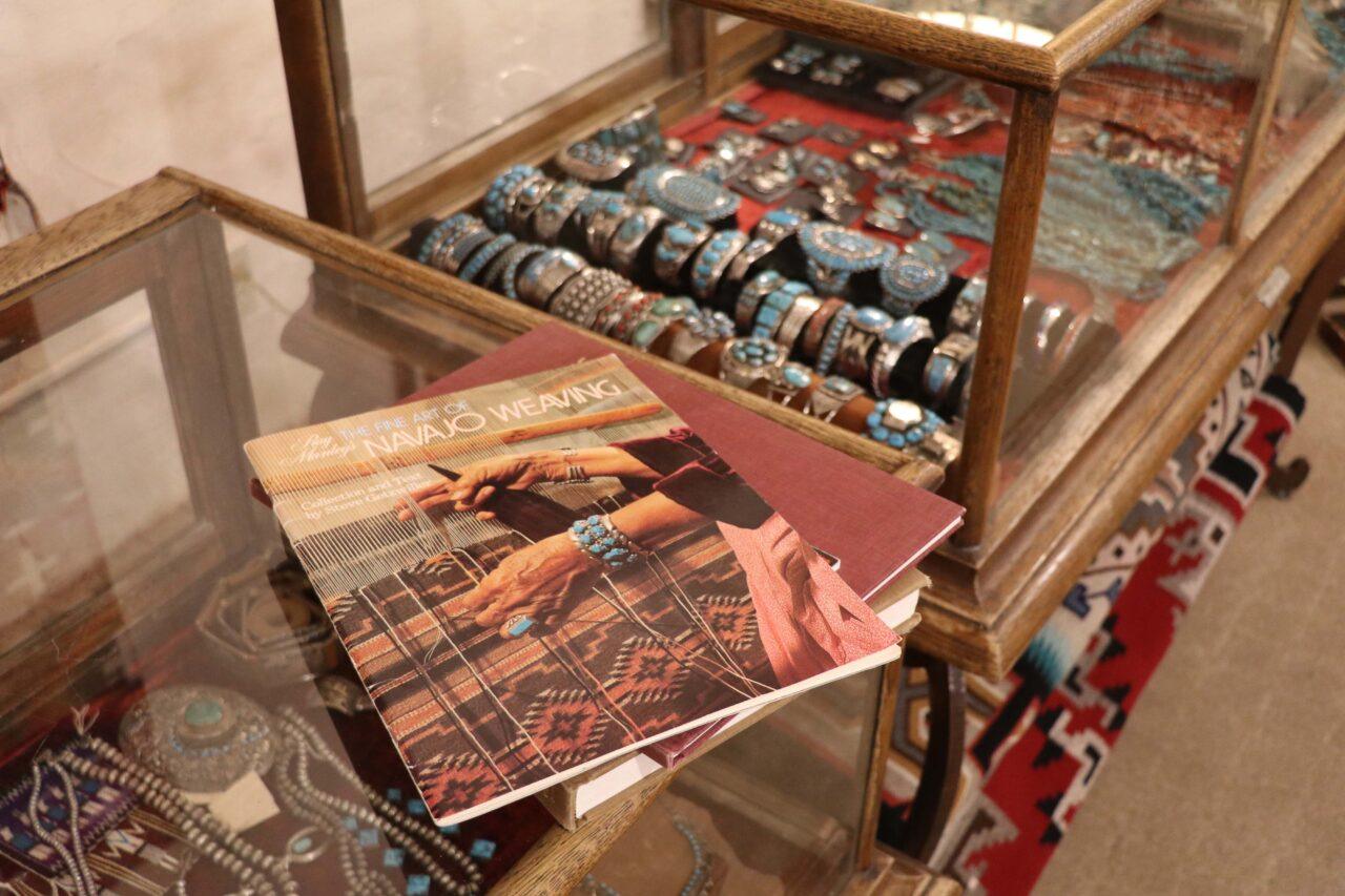
Rapheal Begay (Diné), Rug Room (Teec Nos Pos Trading Post, Teec Nos Pos, AZ), October 2021. Digital photograph. Courtesy the artist.
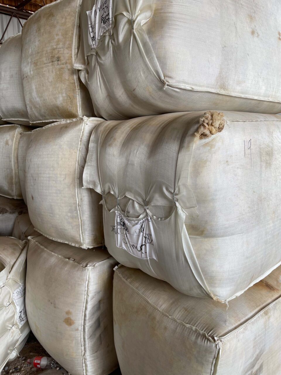
Rapheal Begay (Diné), Packaged Churro (Teec Nos Pos Trading Post, Teec Nos Pos, AZ), October 2021. Digital photograph. Courtesy the artist.
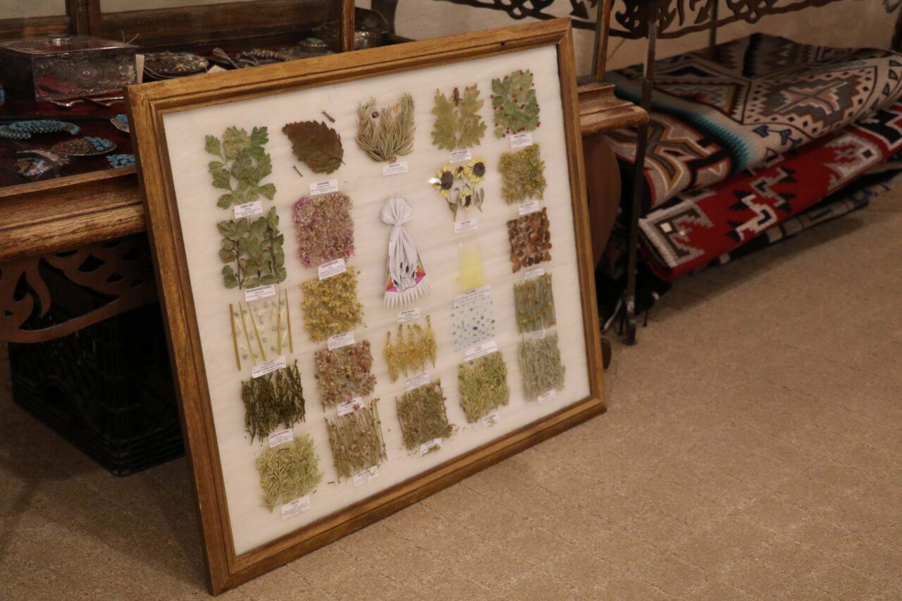
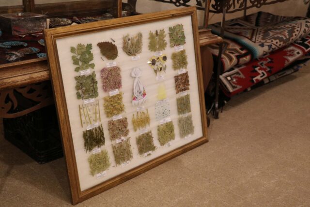
Rapheal Begay (Diné), Dye Plants (Teec Nos Pos Trading Post, Teec Nos Pos, AZ), October 2021. Digital photograph. Courtesy the artist.

Rapheal Begay (Diné), Weavings (Teec Nos Pos Trading Post, Teec Nos Pos, AZ), October 2021. Digital photograph. Courtesy the artist.


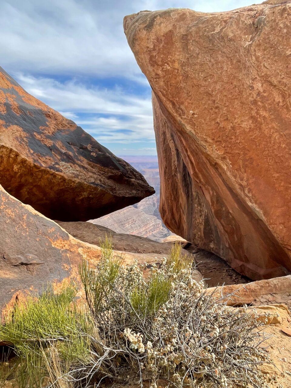
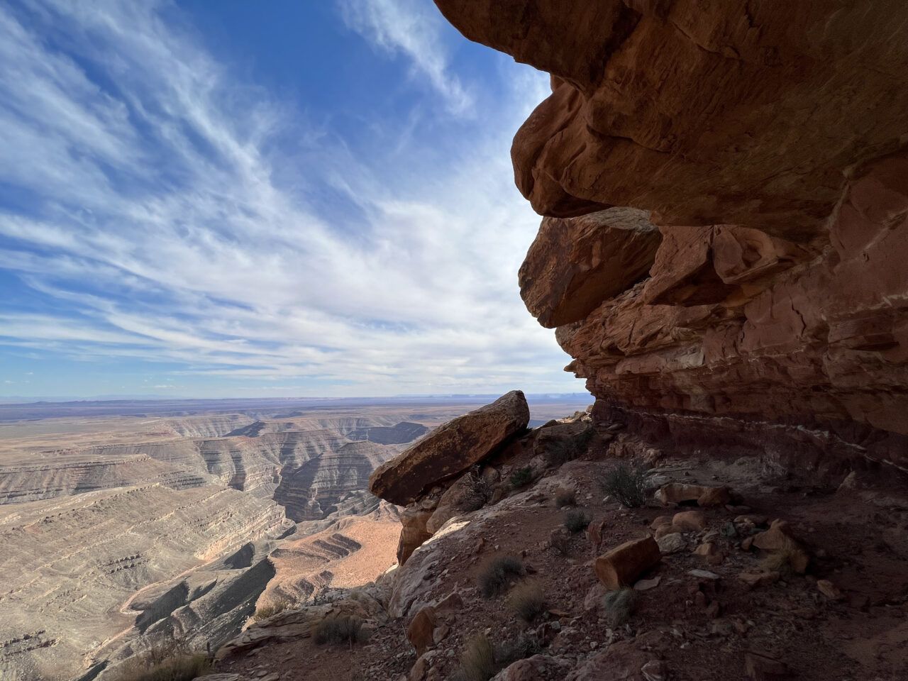
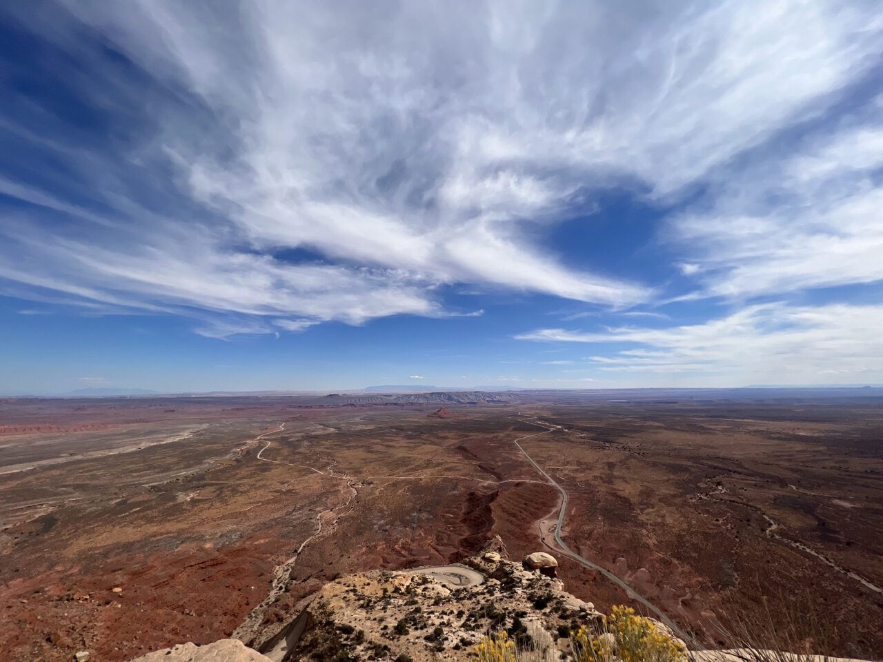
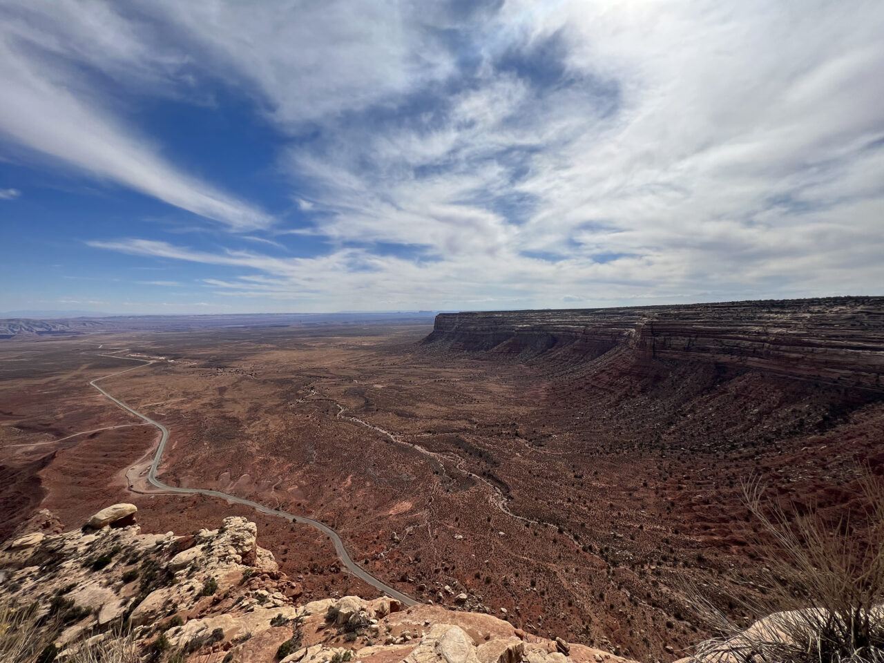
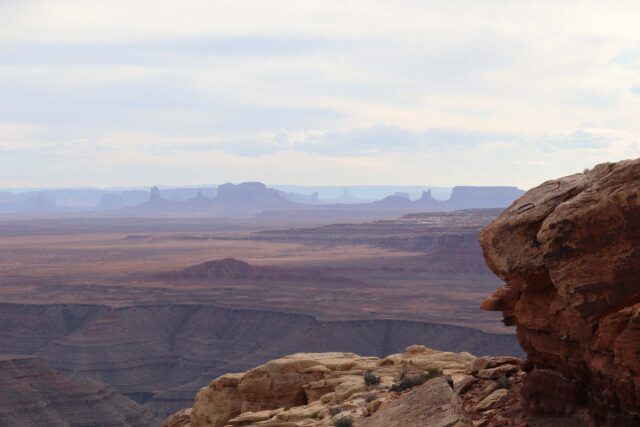
Muley Point, Valley of the Gods, Mexican Hat, Utah
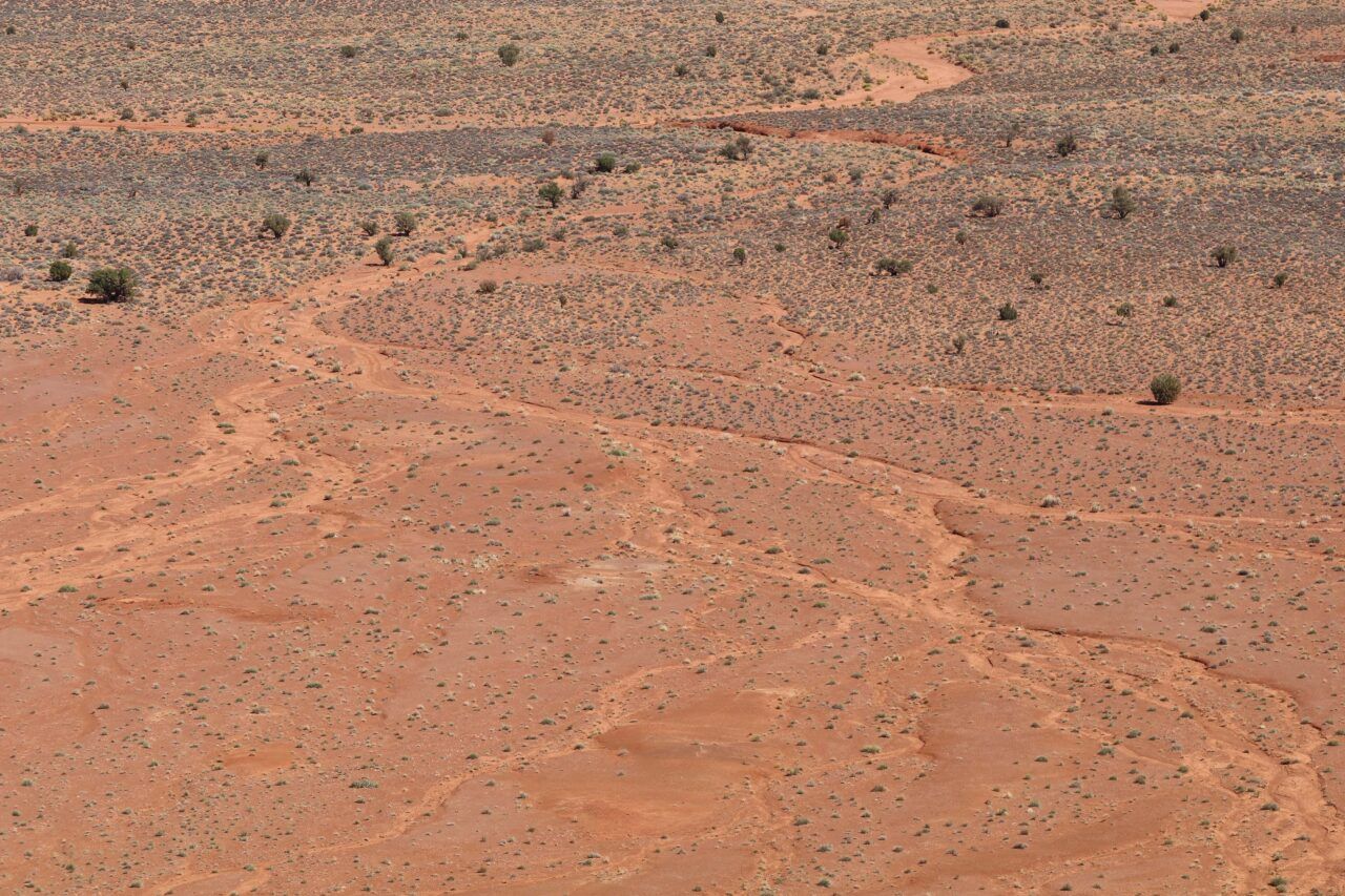
Located in southeastern Utah near Mexican Hat, Muley Point is perched atop a plateau overlooking the Valley of the Gods. Facing south, the Cedar Mesa sandstone formations and Monument Valley are visible in the distance. Once the shore of an ancient sea, the rock formations in the valley are deposits from the Permian age, over 250 million years old. For many Diné (Navajo), it is believed that these formations are ancient warriors, frozen in time, who can provide protection.
Rapheal Begay (Diné), Reverence (Muley Point, Valley of the Gods, Mexican Hat, UT), October 2021. Digital photograph. Courtesy the artist.
Rapheal Begay (Diné), Aerial Trail (Muley Point, Valley of the Gods, Mexican Hat, UT), October 2021. Digital photograph. Courtesy the artist.
Rapheal Begay (Diné), Grounded (Muley Point, Valley of the Gods, Mexican Hat, UT), October 2021. Digital photograph. Courtesy the artist.

Rapheal Begay (Diné), Monuments (Muley Point, Valley of the Gods, Mexican Hat, UT), October 2021. Digital photograph. Courtesy the artist.

Muley Point, Valley of the Gods, Mexican Hat, Utah, October 2021. Digital photograph. Photo: Jesse Merandy.
Muley Point, Valley of the Gods, Mexican Hat, Utah, October 2021. Digital photograph. Photo: Jesse Merandy.
Muley Point, Valley of the Gods, Mexican Hat, Utah, October 2021. Digital photograph. Photo: Jesse Merandy.

Muley Point, Valley of the Gods, Mexican Hat, Utah, October 2021. Digital photograph. Photo: Jesse Merandy.
Muley Point, Valley of the Gods, Mexican Hat, Utah, October 2021. Digital photograph. Photo: Jesse Merandy.

Muley Point, Valley of the Gods, Mexican Hat, Utah, October 2021. Digital photograph. Photo: Jesse Merandy.
Muley Point, Valley of the Gods, Mexican Hat, Utah, October 2021. Digital photograph. Photo: Jesse Merandy.


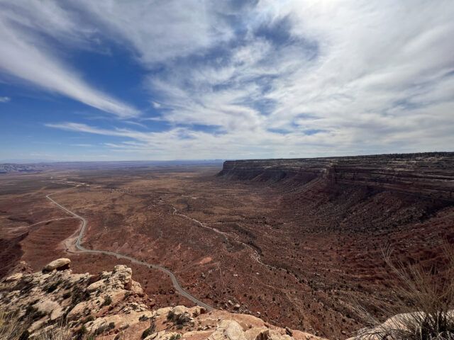
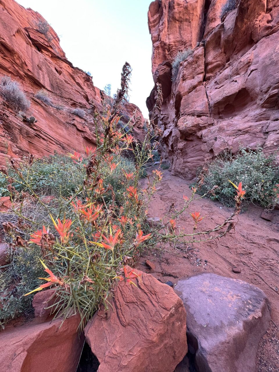
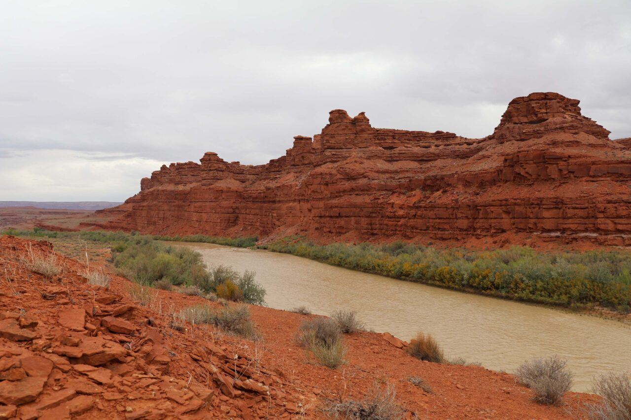
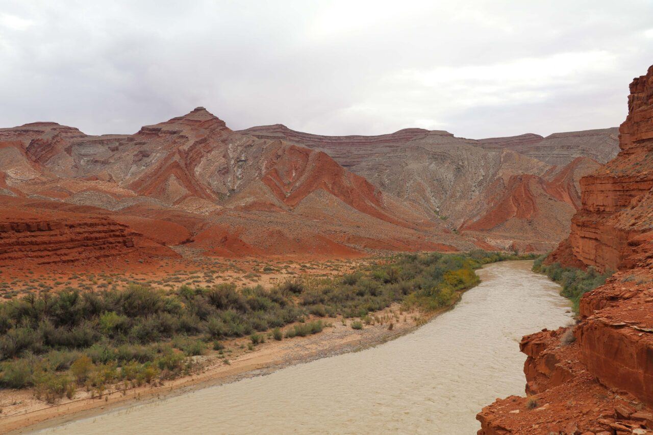
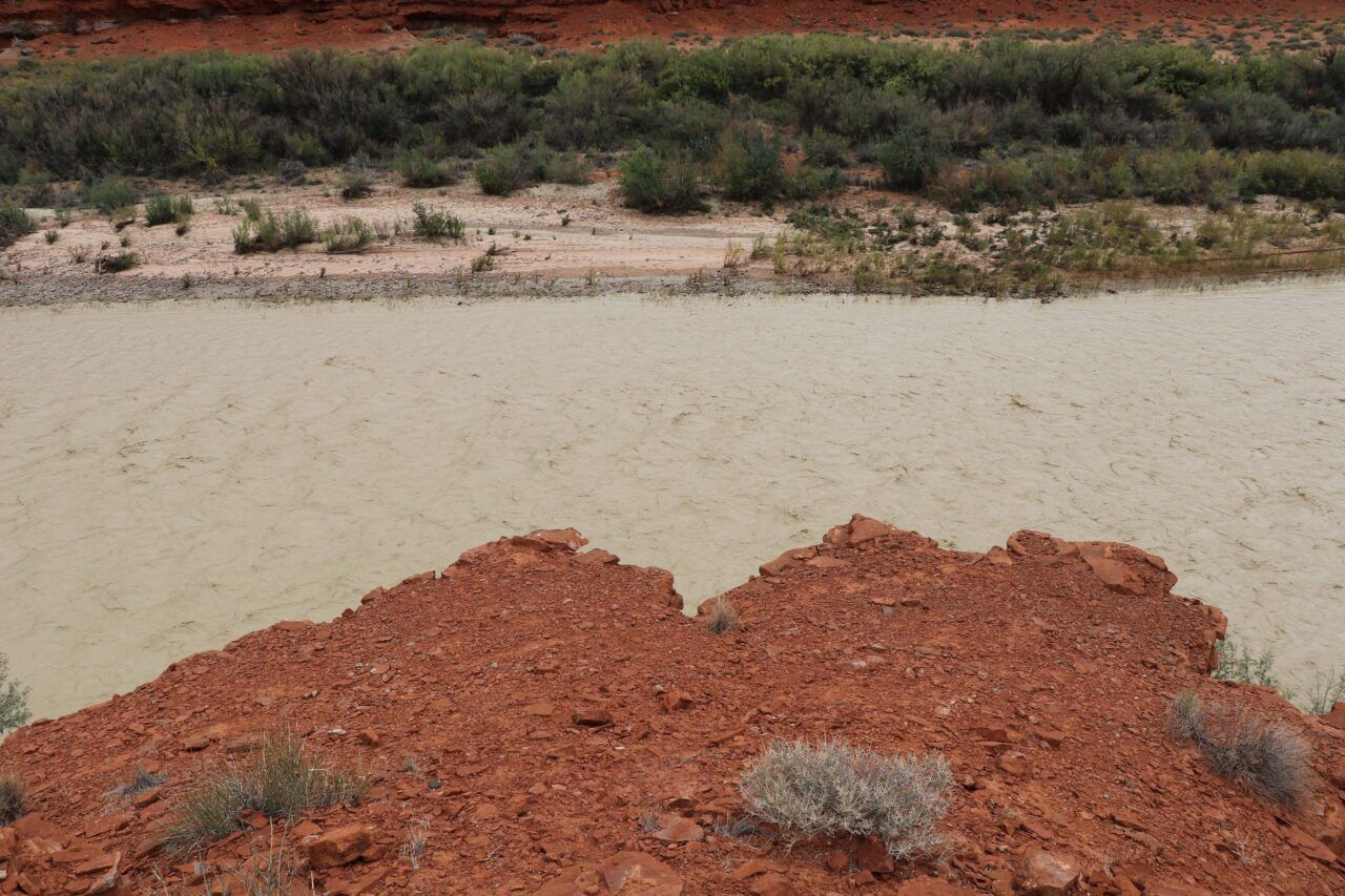
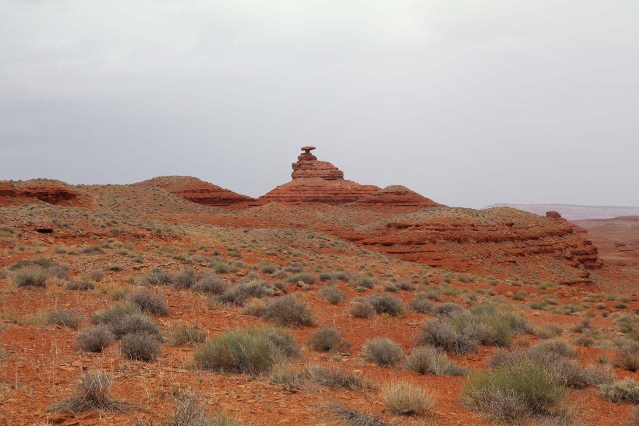
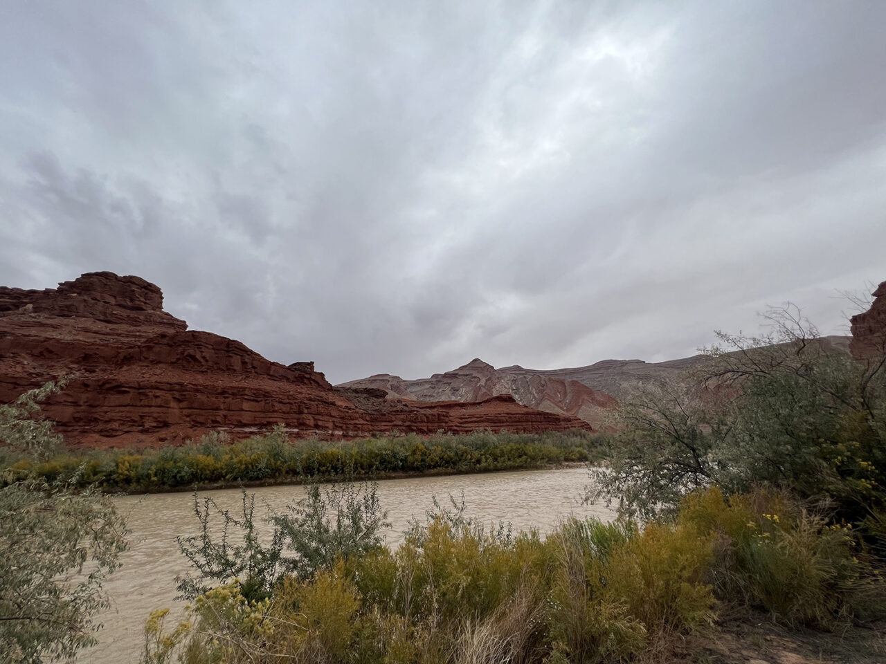
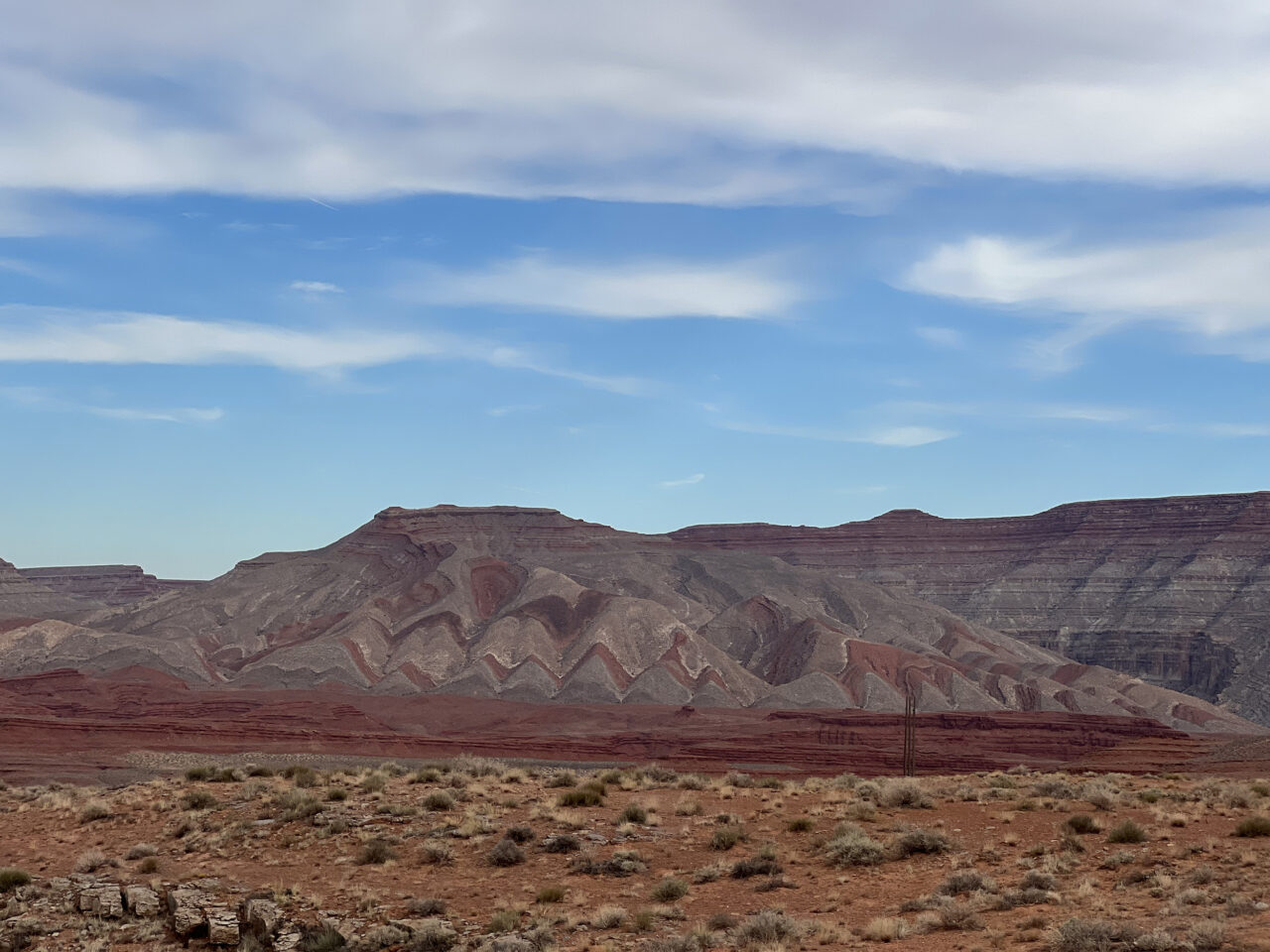
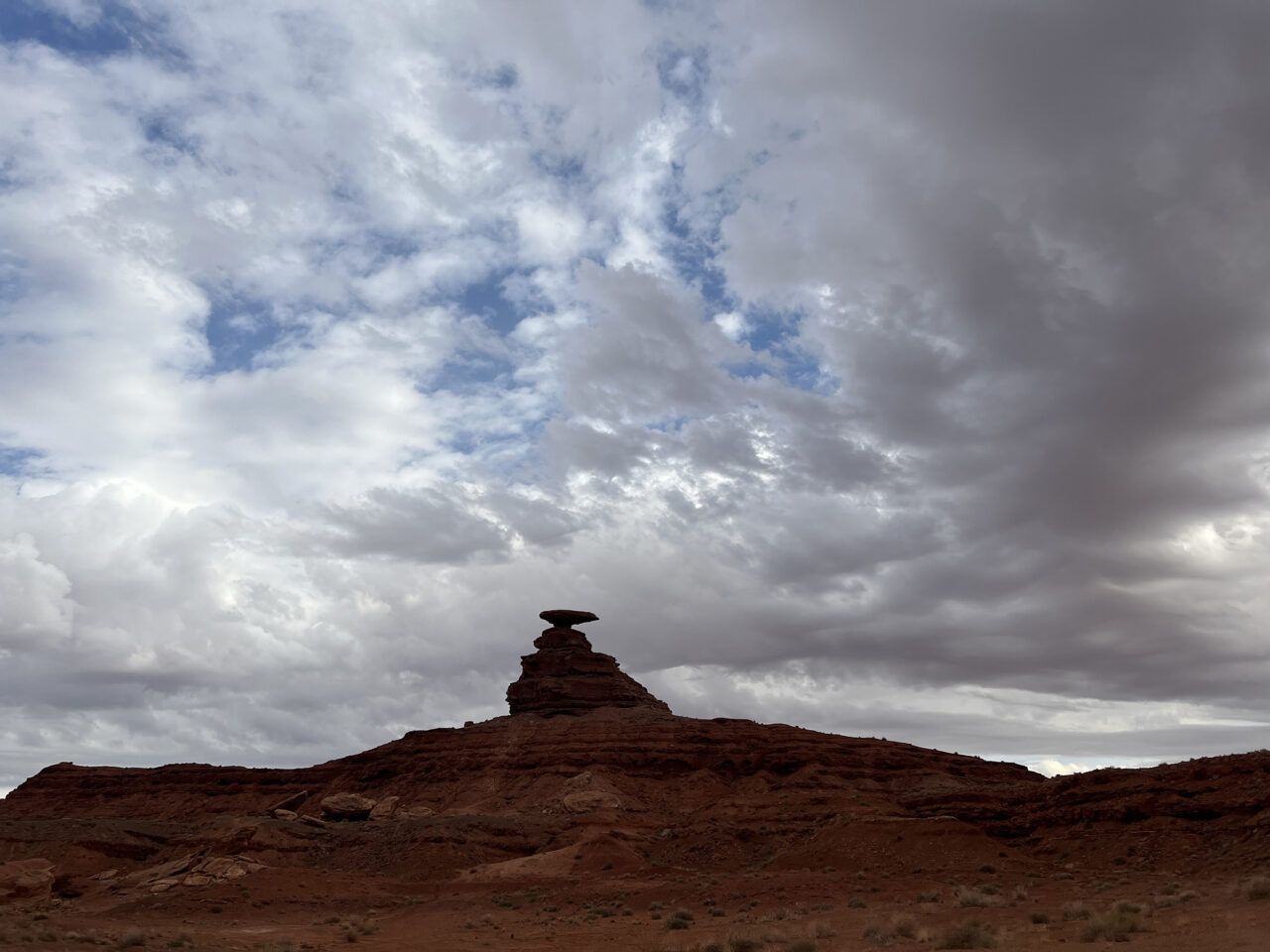
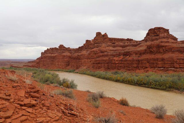
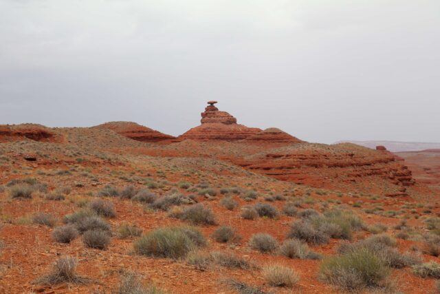
Raplee Ridge, Mexican Hat, Utah
Located in southeastern Utah, Raplee Ridge monocline is a step-like fold in rock strata that features a distinctive zigzag pattern created by the erosion of overlapping layers of light-brown sandstone, reddish-brown siltstone and sandstone, and multicolored siltstone, shale, and limestone. With the waters of the San Juan River below, its unique topography evokes the geometric shapes and earth-toned colors found in some Diné (Navajo) weavings. Nearby, the Mexican Hat rock formation, named for its likeness to a sombrero, features a sandstone caprock balanced atop a cone of red shale and siltstone. Although the region is not frequently cited in Diné historical sources, it is known for its connection to Big Snake, a mythological creature of protection.
Rapheal Begay (Diné), Red Rock and River (Raplee Ridge Monocline, Mexican Hat, UT), October 2021. Digital photograph. Courtesy the artist.
Rapheal Begay (Diné), Raplee Monocline (Raplee Ridge Monocline, Mexican Hat, UT), October 2021. Digital photograph. Courtesy the artist.
Rapheal Begay (Diné), On the Edge (Raplee Ridge Monocline, Mexican Hat, UT), October 2021. Digital photograph. Courtesy the artist.
Rapheal Begay (Diné), Looking West (Mexican Hat Rock Formation, Mexican Hat, UT), October 2021. Digital photograph. Courtesy the artist.
Rapheal Begay (Diné), Tó (San Juan River, Mexican Hat, UT), October 2021. Digital photograph. Courtesy the artist.
Raplee Ridge monocline and San Juan River, Mexican Hat, Utah, October 2021. Digital photograph. Photo: Jesse Merandy.
Raplee Ridge monocline, Mexican Hat, Utah, October 2021. Digital photograph. Photo: Jesse Merandy.

Raplee Ridge monocline, Mexican Hat, Utah, October 2021. Digital photograph. Photo: Jesse Merandy.
Mexican Hat rock formation, Utah, October 2021. Digital photograph. Photo: Jesse Merandy.


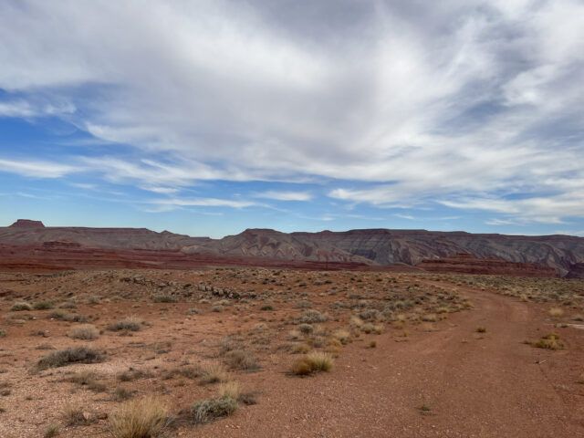

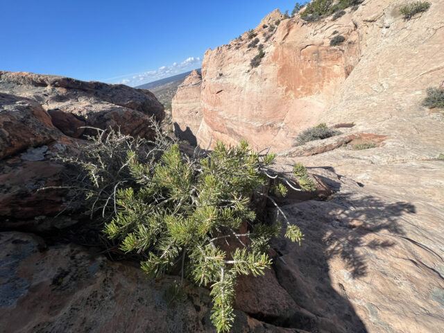
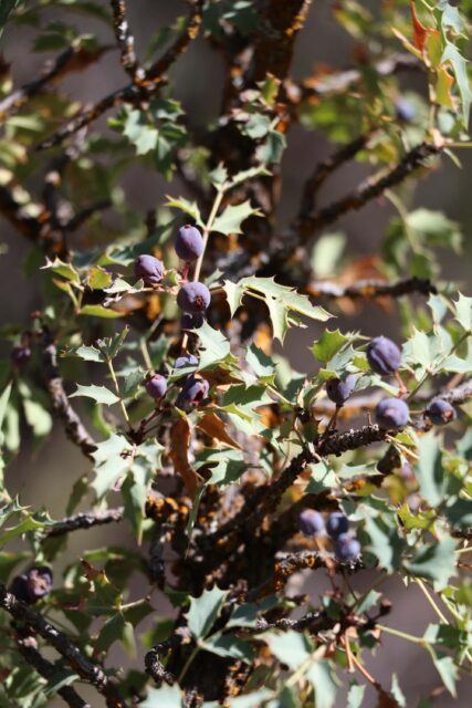
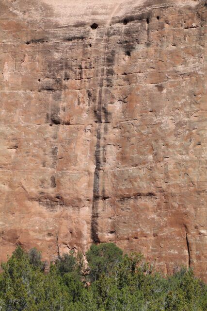
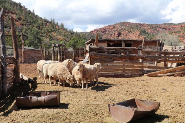
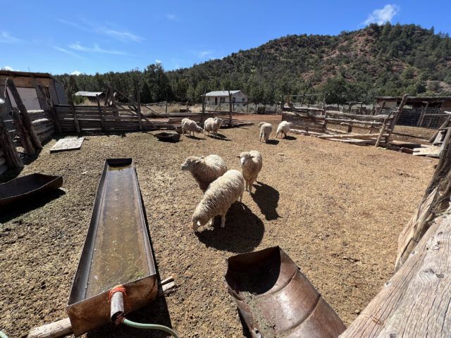
Hunters Point and Oak Springs, Arizona
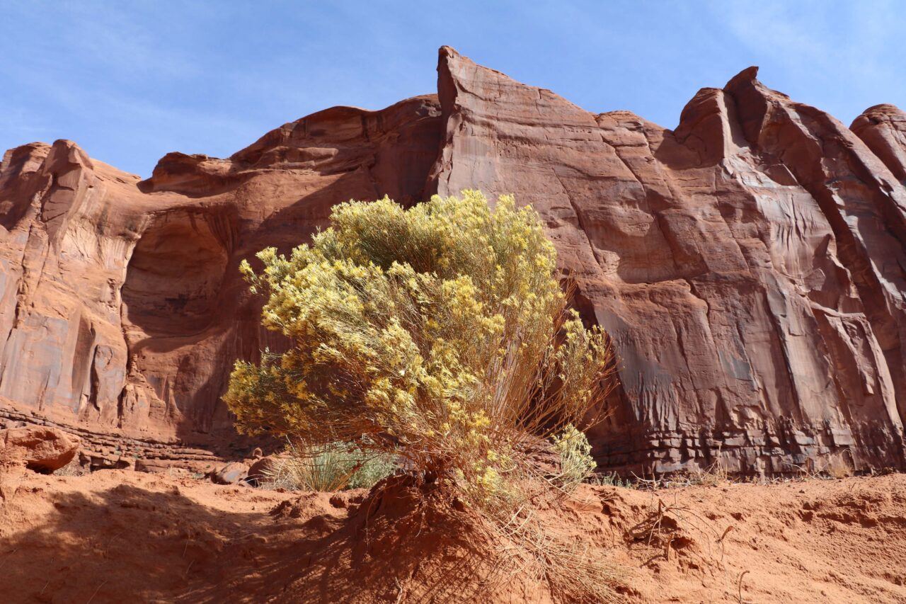
The communities of Hunters Point and Oak Springs (Teelch’init’i’i, “Cattails in a Row”), are located in Apache County, Arizona. Hunters Point is nine miles southwest of Window Rock and is home to the Hunters Point Trading Post, once frequented by Diné traders. Nearby lies the small chapter community of Oak Springs, which shares its name with the surrounding natural spring where it was founded. As the name implies, the area is rich in timber as well as the plants that Diné weavers use for natural dyes (almost 300 dye-yielding plant species are available in the area).

Rapheal Begay (Diné), Berries (Oak Springs, AZ), October 2021. Digital photograph. Courtesy the artist.
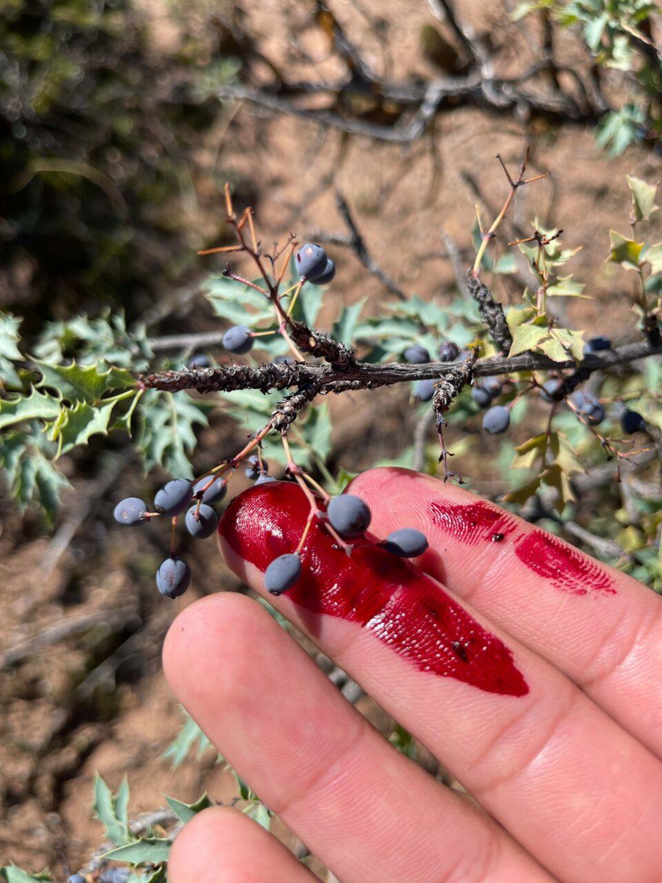
Rapheal Begay (Diné), Berries (Oak Springs, AZ), October 2021. Digital photograph. Courtesy the artist.
Rapheal Begay (Diné), Facade (Oak Springs, AZ), October 2021. Digital photograph. Courtesy the artist.

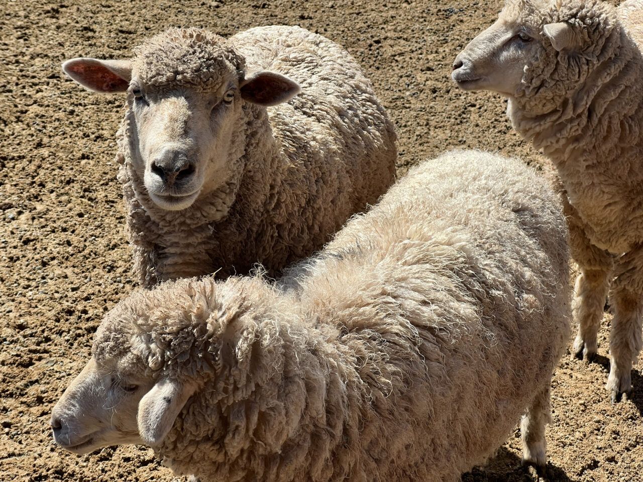
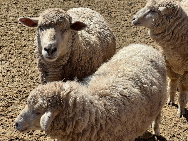
Rapheal Begay (Diné), Sheep (Hunter’s Point, AZ), October 2021. Digital photograph. Courtesy the artist.
Hunter’s Point, Arizona, October 2021. Digital photograph. Photo: Jesse Merandy.

Hunter’s Point, Arizona, October 2021. Digital photograph. Photo: Jesse Merandy.
Hunter’s Point, Arizona, October 2021. Digital photograph. Photo: Jesse Merandy.
Oak Springs, Arizona, October 2021. Digital photograph. Photo: Jesse Merandy.

Oak Springs, Arizona, October 2021. Digital photograph. Photo: Jesse Merandy.
Oak Springs, Arizona, October 2021. Digital photograph. Photo: Jesse Merandy.


Experiencing the Navajo Nation
Early in our collaboration on this exhibition, the team involved with this map project discussed the possibility of visiting and documenting a selection of locations in the Navajo Nation. Our intention was to provide an immersive entry point to Dinétah, as well as to make visible the connection between homeland and Diné (Navajo) textiles, creativity, thought, and being. As a photographer, visiting these locations has always been a way to activate my attention to the details of a landscape, helping to draw my gaze to the many layers, shapes, surfaces, and textures around me. It is an active learning experience that transforms physical spaces into sites of curiosity, inquiry, and wonder.
I hope that through our accumulated field recordings, stills, and videos you will also be able to appreciate these sites in this way and develop a more holistic understanding of Diné space and time. We invite you to stand among the rabbitbrush and observe the land, the vegetation growing on cliffsides between rock slabs, the sheep in their corral, the sky and scattered clouds above. We encourage you to contemplate the connection and relationship between each of these elements and the makers and textiles featured throughout the project. And finally, we offer this project to the Diné community as a way to position themselves in their surroundings and in the world. It is a way to acknowledge the importance of our homeland as a source of pride, hope, and identity, as well as our connection and responsibility to one another.
—Rapheal Begay (Diné)
The following soundscape is an original composition by Diné pianist and composer Connor Chee, created to accompany the 360 imagery included in the exhibition. It layers audio field recordings made at the locations featured in this interactive with a dreamlike medley of original works, including “Weaving,” “Sheep,” and “Female Rain” (all from Chee’s 2020 release, Scenes of Dinétah), and a Navajo traditional, “Girl’s Dance Song.”
Connor Chee (Diné, b. 1987), Landscapes, 2023. Original composition with samples of field recordings by Hadley Welch Jensen and Jesse Merandy, 10 min., 50 sec., no narration. Courtesy the artist.
Support for this project provided by NYU Gallatin’s WetLab.
Film and photography permit approved by Navajo Nation TV & Film, Window Rock, Arizona.